
Country United States County Berkshire Incorporated 1762 Elevation 275 m Population 327 (2010) | Settled 1735 Time zone Eastern (UTC-5) Zip code 01264 Local time Monday 2:17 PM | |
 | ||
Weather 4°C, Wind E at 11 km/h, 89% Humidity | ||
How to say or pronounce usa cities tyringham massachusetts
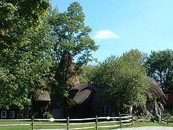
Tyringham is a town in Berkshire County, Massachusetts, United States. It is part of the Pittsfield, Massachusetts Metropolitan Statistical Area. The population was 327 at the 2010 census.
Contents
- How to say or pronounce usa cities tyringham massachusetts
- Map of Tyringham MA USA
- History
- Geography
- Demographics
- Government
- Education
- Points of interest
- Notable residents
- References
Map of Tyringham, MA, USA
History
Founded as Housatonic Township Number 1, the land which became Tyringham and Monterey was first settled in 1735. The two main villages were set up along two waterways, Hop Brook to the north and the Konkapot River to the south. In 1750, Adonijah Bidwell, a Yale Divinity School graduate from the Hartford region, became the first minister of Township No. 1. When a meetinghouse was founded in the south, it led to a buildup in the north, and by 1767 the town was incorporated and named for Tyringham, a village in Buckinghamshire, England. The town was home to the Tyringham Shaker Settlement Historic District, with the Shaker holy name of "Jerusalem", which lay just south of the town center. The town of Monterey was set off and incorporated as its own town in 1847. The town was the site of several small country estates for the wealthy, most of which are long gone, leaving Tyringham as a small, rural community.
Geography
According to the United States Census Bureau, the town has a total area of 18.9 square miles (48.9 km2), of which 18.6 square miles (48.3 km2) is land and 0.23 square miles (0.6 km2), or 1.20%, is water. The town is four-sided, bordered by Lee to the north, Becket and Otis to the east, Monterey to the south, and Great Barrington to the west. Tyringham is located 16 miles (26 km) south of Pittsfield, 39 miles (63 km) west-northwest of Springfield, and 125 miles (201 km) west of Boston.
Tyringham is located in the Hop Brook Valley in the Berkshire Hills. To the northeast of the valley, Baldy Mountain rises to a large plateau which stretches into the neighboring towns, and includes Goose Pond. To the southwest of the valley, two mountain peaks - Mount Wilcot and Hunger Mountain - rise in a plateau in neighboring Monterey. The Appalachian Trail passes through the town, winding down Sky Hill (a part of Mount Wilcot), then sweeps through the valley and over Baldy Mountain and towards Becket Mountain.
Tyringham is one of just fifteen towns in Massachusetts (and only two, along with Mount Washington, in Berkshire County) which is not served by any state routes of any type. Interstate 90 (the Massachusetts Turnpike) and U.S. Route 20 pass just north of the town's northeast corner, and Massachusetts Route 23 passes through neighboring Monterey to the south. The main road through town (named "Main Road") passes between this route to the south and Route 102 in Lee, just south of the point where it meets Route 20 at I-90 Exit 2. There are no rail or bus services in the town, with the nearest regional service for both being in Great Barrington. The nearest national air service can be reached at Bradley International Airport in Connecticut.
Demographics
As of the census of 2000, there were 350 people, 133 households, and 98 families residing in the town. By population, the town ranks 30th out of 32 cities and towns in Berkshire County, and 345th out of the 351 in Massachusetts. The population density was 18.7 people per square mile (7.2/km²), which ranks 28th in the county and 342nd in the Commonwealth. There were 265 housing units at an average density of 14.2 per square mile (5.5/km²). The racial makeup of the town was 95.43% White, 0.29% African American, 0.29% Native American, 2.57% Asian, and 1.43% from two or more races. Hispanic or Latino of any race were 0.29% of the population.
There were 133 households out of which 24.1% had children under the age of 18 living with them, 66.2% were married couples living together, 6.0% had a female householder with no husband present, and 25.6% were non-families. 20.3% of all households were made up of individuals and 9.0% had someone living alone who was 65 years of age or older. The average household size was 2.56 and the average family size was 2.93.
In the town, the population was spread out with 18.6% under the age of 18, 6.6% from 18 to 24, 18.9% from 25 to 44, 40.6% from 45 to 64, and 15.4% who were 65 years of age or older. The median age was 48 years. For every 100 females there were 101.1 males. For every 100 females age 18 and over, there were 103.6 males.
The median income for a household in the town was $60,250, and the median income for a family was $67,679. Males had a median income of $42,708 versus $31,250 for females. The per capita income for the town was $35,503. None of the families and 3.5% of the population were living below the poverty line, including no under eighteens and none of those over 64.
Government
Tyringham uses the open town meeting form of government, and is led by a board of selectmen and an administrative assistant. The town has a police department, fire department and post office, as well as a library, which is adjacent to the town hall and is part of the regional library network. The nearest courthouses and hospital, Fairview Hospital, are located in Great Barrington.
On the state level, Tyringham is represented in the Massachusetts House of Representatives by the Fourth Berkshire district, which covers southern Berkshire County, as well as the westernmost towns in Hampden County. In the Massachusetts Senate, the town is represented by the Berkshire, Hampshire and Franklin district, which includes all of Berkshire County and western Hampshire and Franklin counties. The town is patrolled by the First (Lee) Station of Barracks "B" of the Massachusetts State Police.
On the national level, Tyringham is represented in the United States House of Representatives as part of Massachusetts's 1st congressional district, and has been represented by Richard Neal of Springfield since January 2013. Massachusetts is currently represented in the United States Senate by senior Senator Elizabeth Warren and junior Senator Ed Markey
Education
Tyringham students are sent to Lee Public Schools by arrangement with that town. Lee Elementary School serves students from pre-kindergarten through sixth grades, and the Lee Middle and High School serves students from seventh through twelfth grades. Additionally, neighboring Lee is home to Saint Mary's School, a parochial school which serves students through eighth grade. Other private schools can be found in Great Barrington and other surrounding towns.
The nearest community college is the South County Center of Berkshire Community College in Great Barrington. The nearest state college is Westfield State University. The nearest private college is Bard College at Simon's Rock.
Points of interest
Notable residents
Actor William Roerick lived at his Lost Farm homestead in Tyringham; among the various visitors was E. M. Forster, who dedicated his last book, Two Cheers for Democracy to "William Roerick and 'The Lost Farm' in Tyringham, Massachusetts".