
Existed: by 1933 – present Length 19.84 km | ||
 | ||
History: Assigned ca. 1950 to current alignment County | ||
Route 102 is a west–east state highway in western Massachusetts.
Contents
Map of MA-102, Massachusetts, USA
Route description
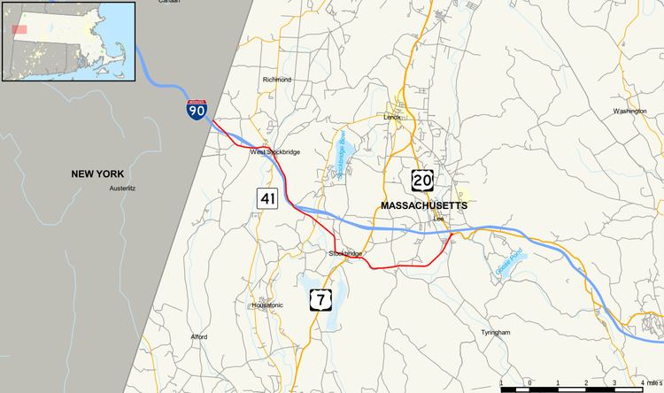
Route 102 begins in West Stockbridge at the New York state line, connected to New York State Route 22 (NY 22) by unsigned NY 980D in Canaan, New York. The route crosses Interstate 90 (Massachusetts Turnpike) twice in its first two miles before joining Route 41 for a half-mile concurrency through the center of town, crossing the Williams River below Shaker Mill Pond. The concurrency ends just north of exit 1 of the Mass Pike, a partial turn-around exit.
From West Stockbridge, Route 102 enters Stockbridge. It crosses the Mass Pike once more before intersecting Route 183 in the Larrywaug section of town. It then continues southeast before turning due east along Stockbridge's Main Street, passing concurrently with U.S. Route 7 (US 7) for a quarter-mile. The route then continues eastward, just north of the Housatonic River as it passes into Lee. Once in Lee, the route turns northeastward, crossing the Housatonic just before its eastern terminus at the junction of US 20 and the entrance ramps to exit 2 of the Mass Pike.
Major intersections
The entire route is in Berkshire County.