
- elevation 778 m (2,552 ft) - elevation 406 m (1,332 ft) Bridges Wallaby Rocks Bridge | ||
 | ||
Gold crevicing on the turon river nsw australia jan 2012
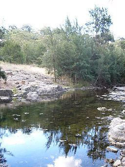
Turon River, a perennial stream that is part of the Macquarie catchment within the Murray–Darling basin, is located in the central western district of New South Wales, Australia. Partly situated in the Turon National Park, the river is host to numerous recreational and tourist activities such as horseback riding, gold panning, canoeing, camping, and seasonal fishing.
Contents
- Gold crevicing on the turon river nsw australia jan 2012
- Map of Turon River New South Wales Australia
- Turon river 4wd river track
- GeographyEdit
- Gold rushEdit
- References
Map of Turon River, New South Wales, Australia
Turon river 4wd river track
GeographyEdit
The Turon River rises on the western slopes of the Great Dividing Range in the Capertee Valley, west of Ben Bullen, and flows generally to the north west and then west, joined by the Crudine River, and then forms its confluence with the Macquarie River south west of Hill End; dropping 372 metres (1,220 ft) over the course of its 117 kilometres (73 mi) length.
The upper reaches of the Turon River are partly bound by Turon National Park, established in 2002, while the lower reaches open onto private grazing property.
Gold rushEdit
The Turon River is well renowned because it was the site of one of Australia's first alluvial gold rushes. During the gold rush Chinese migrant workers built a water race to bring water to mining operations along sections of the Turon River. Many parts of the race can still be seen today, such as at Turon Gates. The Turon River was the site of violence between miners and licensing authorities during the gold rush.