
Parent range Sierra Nevada Elevation 3,539 m Mountain range Sierra Nevada | Topo map USGS Mount Lyell Easiest route Scramble, class 3 Prominence 198 m | |
 | ||
Similar Merced Peak, Mount Ansel Adams, Mount Maclure, Mount Clark, Mount Lyell | ||
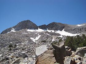
Triple Divide Peak is a mountain on the boundary between Yosemite National Park and the Ansel Adams Wilderness in Madera County, California. It is located 0.7 miles (1.1 km) north of Walton Lake and 1.3 miles (2.1 km) southeast of Merced Peak. Its name refers to the fact that it lies on the boundaries of three distinct watersheds, namely those of the Merced, South Fork Merced, and San Joaquin rivers.
Map of Triple Divide Peak, California, USA
References
Triple Divide Peak (Madera County, California) Wikipedia(Text) CC BY-SA