
Topo map USGS Merced Peak Elevation 3,574 m | Easiest route Scramble, class 2 Prominence 368 m | |
 | ||
Similar Mount Clark, Triple Divide Peak, Mount Lyell, Vogelsang Peak, Mount Starr King | ||
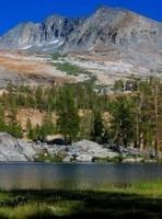
Merced Peak, with an elevation of 11,731 feet (3,576 m), is the highest point in the Clark Range, just surpassing three other peaks; Red Peak (11,704 feet), Gray Peak (11,578 feet), and Mount Clark (11,527 feet).
Map of Merced Peak, California, USA
Merced Peak is located close to southern border of Yosemite National Park, near the Ottoway Lakes. The summit can be approached from the Quartz Mountain Trailhead over Chiquito pass or from one of two trailheads on the road to Glacier Point.
In 1871, Influential Scottish-American glaciologist John Muir discovered an active alpine glacier below Merced Peak, which helped his theories gain acceptance.
References
Merced Peak Wikipedia(Text) CC BY-SA