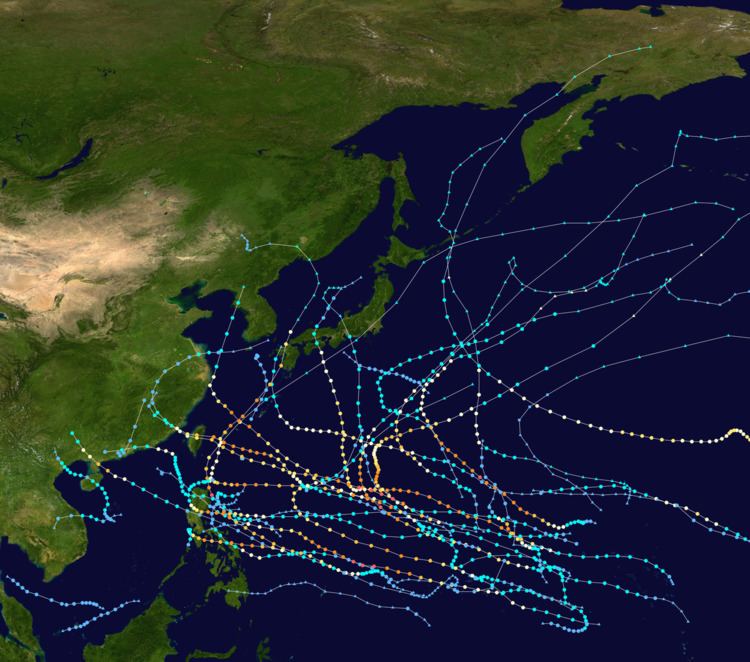
This timeline documents all of the events of the 2015 Pacific typhoon season. Most of the tropical cyclones forming between May and November. The scope of this article is limited to the Pacific Ocean, north of the equator between 100°E and the International Date Line. Tropical storms that form in the entire Western Pacific basin are assigned a name by the Japan Meteorological Agency. Tropical depressions that form in this basin are given a number with a "W" suffix by the United States' Joint Typhoon Warning Center. In addition, the Philippine Atmospheric, Geophysical and Astronomical Services Administration (PAGASA) assigns names to tropical cyclones (including tropical depressions) that enter or form in the Philippine area of responsibility. These names, however, are not in common use outside of the Philippines.
During the season, 36 systems were designated as Tropical Depressions by either, the Japan Meteorological Agency (JMA), the Philippine Atmospheric, Geophysical and Astronomical Services Administration (PAGASA), the Joint Typhoon Warning Center (JTWC), or other National Meteorological and Hydrological Services such as the China Meteorological Administration and the Hong Kong Observatory. As they run the Regional Specialized Meteorological Centre for the Western Pacific, the JMA assigns names to Tropical Depressions should they intensify into a tropical storm. PAGASA also assign local names to tropical depressions which form within their area of responsibility; however, these names are not in common use outside of PAGASA’s area of responsibility. In this season, 13 systems entered or formed in the Philippine area of responsibility, which six of them directly made landfall over the Philippines.
The first five months of the season were unusually active and intense due to a developing El Niño. Mekkhala became an early-forming storm of the season and affected the Philippines. Whilst Higos, which formed a month after Mekkhala, reached its peak intensity as a Category 4 typhoon and broke the record of the most intense storm and the easternmost forming storm within the basin during the month of February. During the end of next month, Typhoon Maysak reached its peak intensity as a Category 5 super typhoon with a minimum pressure of 910 millibars, which became the strongest typhoon before the month of April, however Noul became the strongest in terms of windspeeds two months after. In additional, when Dolphin was named on May 9, it became the earliest seventh named storm to form within the basin since 1971. So far this year, ten typhoons underwent rapid deepening.
2015 opened with Tropical Depression Jangmi (Seniang) located about 145 km (90 mi) to the northeast of Sandakan, Malaysia. The system subsequently moved south-eastwards and made landfall on Malaysia before dissipating later that day. A tropical depression subsequently developed to the northwest of Brunei during January 2, but did not develop any further and dissipated during January 4. The first tropical storm of the season was named Mekkhala during January 14 and went on to affect the Philippines and Pope Francis' visit to the Philippines. Less than a month later, Typhoon Higos had become the easternmost forming Pacific typhoon as well as being among the strongest February typhoons of record. Despite its intensity, Higos did not cause any significant effects over the landmasses and islands on the West Pacific. During the end of March, Typhoon Maysak formed and intensified into a Category 5 super typhoon, the strongest so far in the season and the strongest prior to April.
January 100:00 UTC — 2015 starts with Tropical Depression Jangmi (Seniang) located about 145 km (90 mi) to the northeast of Sandakan, Malaysia.12:00 UTC — Tropical Depression Jangmi (Seniang) makes landfall in the Malaysian state of Sabah on the island of Borneo.18:00 UTC — The JMA reports that Tropical Depression Jangmi (Seniang) has dissipated over the Malaysian state of Sabah on the island of Borneo.January 206:00 UTC — The JMA reports that a tropical depression has developed to the northwest of Brunei, within an area that was marginally favourable for further development.January 406:00 UTC — The tropical depression previously located to the northwest of Brunei is last noted by the JMA, as it dissipates in the South China Sea near the border of Malaysia and Indonesia.January 1315:00 UTC - The JTWC (Joint Typhoon Warning Center) monitors a tropical depression was designated as Tropical Depression 01W.January 1406:00 UTC — 01W intensified into a tropical storm by the JMA (Japan Meteorological Agency), naming it Mekkhala.21:00 UTC — Mekkhala entered the Philippine area of Responsibility (PAR), as it was named as Amang by the PAGASA.January 1503:00 UTC — The JTWC upgrades Mekkhala to a tropical storm.January 1612:00 UTC — According to the JMA, Mekkhala intensified into a severe tropical storm.January 1700:00 UTC — The JMA upgraded Mekkhala to a minimal typhoon and reached its peak intensity with 10-minute maximum sustained winds of 110 km/h (70 mph).03:00 UTC — The JTWC in the other hand, classified Mekkhala's peak as a Category 1 typhoon with winds of 130 km/h (80 mph).07:00 UTC — PAGASA had reported that Mekkhala (Amang) had made landfall over Dolores, Eastern Samar of the Philippines.09:00 UTC — Both the JMA and the JTWC downgraded the system to a tropical storm.January 1815:00 UTC — The JTWC downgraded Mekkhala to a tropical depression.18:00 UTC — Mekkhala had fully weakened into a tropical depression.January 2100:00 UTC — The JMA stopped warning on the system as it was absorbed by a stationary front over eastern Luzon.February 706:00 UTC — The JTWC monitors a tropical depression was designated as Tropical Depression 02W.15:00 UTC — The JTWC designates 02W to tropical Storm, as it started to intensify.18:00 UTC — 02W intensified into a tropical storm by the JMA, naming it Higos whilst the JTWC also upgraded Higos to a tropical storm.February 818:00 UTC — The JMA upgrades Higos to a severe tropical storm whilst the JTWC upgraded Higos to a Category 1 typhoon.February 912:00 UTC — The JMA upgrades Higos to a typhoon whilst the JTWC upgraded Higos to a Category 2 typhoon.February 1003:00 UTC — Higos starts to undergo rapid deepening as its eye became more clearer.06:00 UTC — The JTWC classified Higos's peak as a Category 4 typhoon with winds of 215 km/h (130 mph).12:00 UTC — The JTWC reports that Typhoon Higos has weakened and become equivalent to a Category 3 typhoon on the SSHWS.18:00 UTC — The JTWC reports that Typhoon Higos has weakened and become equivalent to a Category 2 typhoon on the SSHWS.21:00 UTC — The JMA reports that Typhoon Higos has weakened into a severe tropical storm.February 1100:00 UTC — The JMA reports that Severe Tropical Storm Higos has weakened into a tropical storm.00:00 UTC — The JTWC reports that Typhoon Higos has weakened and become equivalent to a Category 1 typhoon on the SSHWS.12:00 UTC — The JTWC downgraded Higos to a tropical depression.18:00 UTC — Higos had fully weakened into a tropical depression.February 1306:00 UTC — The JMA stopped warning on the system as it was absorbed by a stationary front over eastern Mariana Islands.March 1006:00 UTC - The JMA starts monitoring a tropical depression that is located about 330 km (205 mi) to the northeast of Bairiki in Kiribati.March 1103:00 UTC — The tropical depression forms and was designated as 03W by the JTWC.06:00 UTC — The JMA reports that the tropical depression has developed into a tropical storm.March 1412:00 UTC — According to both agencies, Bavi had reached its peak strength as a strong tropical storm.March 1718:00 UTC — The PAGASA had reported that Bavi had entered their area, giving the name Betty.21:00 UTC — All three agencies downgrade Bavi to a tropical depression, as moderate to high vertical wind shear caused Bavi's circulation to become exposed.March 2300:00 UTC — Tropical Depression Bavi (Betty) had fully dissipated west of Manila.March 2703:00 UTC — The JTWC starts designating a tropical depression to 04W.15:00 UTC — As of the JTWC, 04W intensified into a tropical storm.18:00 UTC — The JMA followed suit of upgrading it. With this, it was named Maysak.March 2812:00 UTC — Maysak starts to show signs of a developing eye, as it was upgraded to a severe tropical storm by the JMA.18:00 UTC — The JMA upgrades Maysak to a typhoon, even though the JTWC still classifies it as a tropical storm.21:00 UTC — Finally, the JTWC upgrades Maysak to a Category 1 typhoon.March 2918:00 UTC — Maysak intensifies into a Category 2 typhoon as it starts to develop a ragged eye.March 3006:00 UTC — Maysak starts to undergo rapid deepening as its eye became more clearer.18:00 UTC — Due to more favorable environments for the storm, the JTWC upgraded Maysak to a Category 4 super typhoon, as the typhoon strengthened in size as well.March 3109:00 UTC — The JTWC upgrades Maysak to a Category 5 super typhoon with 1-minute sustained winds of 260 km/h (160 mph).April 106:00 UTC — The JTWC reports that Typhoon Maysak has weakened and become equivalent to a Category 4 super typhoon on the SSHWS.15:00 UTC — Maysak enters the PAR, with PAGASA naming it as Chedeng.18:00 UTC — The JTWC reports that Typhoon Maysak has weakened and become equivalent to a Category 4 typhoon on the SSHWS.April 212:00 UTC — The JTWC reports that Typhoon Maysak has weakened and become equivalent to a Category 3 typhoon on the SSHWS.April 300:00 UTC — The JTWC reports that Typhoon Maysak has weakened and become equivalent to a Category 2 typhoon on the SSHWS.03:00 UTC — Tropical Depression 05W develops from a cluster of clouds east of the Caroline Islands and over favorable conditions.18:00 UTC — The JTWC reports that Typhoon Maysak has weakened and become equivalent to a Category 1 typhoon on the SSHWS.April 403:00 UTC — According to the JTWC, 05W had intensified into a tropical storm.03:00 UTC — In the same time, the JMA started issuing advisories on 05W.06:00 UTC — The JMA reports that Typhoon Maysak has weakened into a severe tropical storm.07:00 UTC — The JMA had stated that 05W had intensified into Tropical Storm Haishen.12:00 UTC — The JTWC reports that Typhoon Maysak has weakened to a tropical storm.18:00 UTC — The JMA reports that Severe Tropical Storm Maysak has weakened into a tropical storm.April 506:00 UTC — The JMA downgrades Maysak to a tropical depression, whilst the JTWC still classifies it as a weak tropical storm.18:00 UTC — The JTWC issues its final advisory on Typhoon Maysak as it has weakened into a tropical depression.April 612:00 UTC — The JMA stops warning on Haishen, as it was downgraded to a low-pressure area.April 721:00 UTC — The JMA stops tracking on Tropical Depression Maysak as it was last located over the South China Sea.May 206:00 UTC — The JMA starts to monitor a tropical depression that was located to the east of Palau.May 300:00 UTC — The JTWC starts issuing advisories on the depression as they upgraded it to Tropical Depression 06W.18:00 UTC — Tropical Depression 06W intensifies into Tropical Storm Noul.20:00 UTC — The JTWC reports that Tropical Depression 06W has intensified to a tropical storm.May 518:00 UTC — Tropical Storm Noul intensified into a severe tropical storm by the JMA.May 606:00 UTC — The JMA starts to monitor a new tropical depression just north of the equator near Pohnpei.06:00 UTC — Noul intensifies into a typhoon by the JMA.12:00 UTC — The JTWC upgraded Noul to a Category 1 typhoon.20:00 UTC — Noul enters the PAR, as PAGASA names it Dodong.21:00 UTC — The JTWC starts issuing advisories on the new depression and designates it as 07W.May 700:00 UTC — The JTWC reports that Typhoon Noul has intensified and become equivalent to a Category 2 typhoon on the SSHWS.12:00 UTC — The JTWC reports that Typhoon Noul has intensified and become equivalent to a Category 3 typhoon on the SSHWS.May 912:00 UTC — The JMA upgrades 07W to Tropical Storm Dolphin.12:00 UTC — The JTWC reports that Typhoon Noul has intensified and become equivalent to a Category 4 typhoon on the SSHWS.18:00 UTC — The JTWC reports that Typhoon Noul has intensified and become equivalent to a Category 4 super typhoon on the SSHWS.May 1000:00 UTC — Both the JMA and the JTWC reports that Typhoon Noul had reached its peak intensity as a Category 5 super typhoon with 10-minute sustained windspeeds of 205 km/h (125 mph), which is the strongest this year in terms of windspeeds. .07:00 UTC — PAGASA had reported that Noul (Dodong) made landfall over Santa Ana, Cagayan of the Philippines.12:00 UTC — The JTWC reports that Typhoon Noul has weakened and become equivalent to a Category 4 super typhoon on the SSHWS.18:00 UTC — The JTWC reports that Typhoon Noul has weakened and become equivalent to a Category 4 typhoon on the SSHWS.May 1100:00 UTC — The JTWC reports that Typhoon Noul has weakened and become equivalent to a Category 3 typhoon on the SSHWS.06:00 UTC — The JTWC reports that Typhoon Noul has weakened and become equivalent to a Category 2 typhoon on the SSHWS.12:00 UTC — The JTWC reports that Typhoon Noul has weakened and become equivalent to a Category 1 typhoon on the SSHWS.May 1200:00 UTC — The JTWC reports that Typhoon Noul has weakened to a tropical storm.03:00 UTC — The JMA reports that Typhoon Noul has weakened into a severe tropical storm.06:00 UTC — Both the JMA and the JTWC issues their final advisory on Typhoon Noul as it has transitioned into an extratropical cyclone.May 1300:00 UTC — The JTWC upgrades Dolphin to a Category 1 typhoon.06:00 UTC — The JMA upgrades Dolphin to a typhoon.12:00 UTC — The JTWC upgraded Dolphin to a Category 2 typhoon.May 1518:00 UTC — The JTWC reports that Typhoon Dolphin has intensified and become equivalent to a Category 3 typhoon on the SSHWS.May 1600:00 UTC — The JTWC reports that Typhoon Dolphin has intensified and become equivalent to a Category 4 typhoon on the SSHWS.06:00 UTC — The JTWC reports that Typhoon Dolphin has intensified and become equivalent to a Category 4 super typhoon on the SSHWS.09:00 UTC — The JMA reports that Typhoon Dolphin has reached its peak intensity, with 10-minute sustained windspeeds of 185 km/h (115 mph).18:00 UTC — The JTWC reports that Typhoon Dolphin has intensified and become equivalent to a Category 5 super typhoon on the SSHWS.May 1706:00 UTC — The JTWC reports that Typhoon Dolphin has weakened and become equivalent to a Category 4 super typhoon on the SSHWS.18:00 UTC — The JTWC reports that Typhoon Dolphin has weakened and become equivalent to a Category 4 typhoon on the SSHWS.May 1800:00 UTC — The JTWC reports that Typhoon Dolphin has weakened and become equivalent to a Category 3 typhoon on the SSHWS.12:00 UTC — The JTWC reports that Typhoon Dolphin has weakened and become equivalent to a Category 2 typhoon on the SSHWS.18:00 UTC — The JTWC reports that Typhoon Dolphin has weakened and become equivalent to a Category 1 typhoon on the SSHWS.May 1912:00 UTC — The JTWC issues its final advisory on Typhoon Dolphin as it has weakened below typhoon intensity and transitioned into an extratropical cyclone.May 2000:00 UTC — The JMA reports that Typhoon Dolphin has weakened into a severe tropical storm.18:00 UTC — The JMA reports that Severe Tropical Storm Dolphin has transitioned into an extratropical cyclone.June 1918:00 UTC — The JMA reports that a tropical depression has developed within the South China Sea about 940 km (585 mi) to the southeast of Hanoi, Vietnam.June 2015:00 UTC — The JTWC classifies the tropical depression as Tropical Depression 08W.June 2100:00 UTC — The JMA reports that Tropical Depression 08W has intensified into a tropical storm and names it Kujira.12:00 UTC — The JMA reports that Tropical Storm Kujira has peaked with 10-minute sustained wind speeds of 85 km/h (50 mph).June 2200:00 UTC — The JTWC reports that Kujira has intensified into a tropical storm.June 2300:00 UTC — The JTWC reports that Tropical Storm Kujira has weakened into a tropical depression, as it emerges into the Gulf of Tonkin after impacting Hainan island.06:00 UTC — The JTWC reports that Tropical Depression Kujira has intensified into a tropical storm.June 2400:00 UTC — The JTWC reports that Tropical Storm Kujira has weakened into a tropical depression and issues its final advisory, after the weakening system made landfall to the east of Hanoi, Vietnam.18:00 UTC — The JMA reports that Tropical Storm Kujira has weakened into a tropical depression over land.June 2506:00 UTC — The JMA reports that Tropical Depression Kujira has dissipated, over land to the north of Hanoi, Vietnam.June 3000:00 UTC — The JMA starts to monitor another tropical depression near Kosrae.July 100:00 UTC — The JMA starts to monitor a tropical depression just east of Visayas, Philippines.12:00 UTC — The JMA starts to monitor weak tropical depression over the Caroline Islands and southwest of Chan-hom.July 203:00 UTC — The tropical depression near Visayas was monitored by the PAGASA, which gave the local name Egay.03:00 UTC — Egay was then upgraded to Tropical Depression 10W by the JTWC.06:00 UTC — The other tropical depression was absorbed by the nearby and intensifying Chan-hom.July 300:00 UTC — Another tropical depression develops over the Marshall Islands, according to the JMA.03:00 UTC — Both the JMA and JTWC downgrade Chan-hom to a strong tropical storm.06:00 UTC — Linfa intensifies into a severe tropical storm.12:00 UTC — The JTWC designates the tropical depression, 11W.18:00 UTC — The JMA upgrades 11W to Tropical Storm Nangka.July 606:00 UTC — The JTWC upgrades Nangka to a typhoon, as a ragged eye forms.July 715:00 UTC — Typhoon Chan-hom enters the PAR, with PAGASA assigning the local name Falcon.July 818:00 UTC — The JTWC upgrades Linfa to a minimal typhoon.July 906:00 UTC — Nangka intensifies into a super typhoon.18:00 UTC — Chan-hom intensifies into a Category 4 typhoon.18:00 UTC — Chan-hom exits the PAR and PAGASA issues their final warning on the typhoon.July 1006:00 UTC — Tropical Depression Linfa fully dissipates over land.July 1221:00 UTC — Tropical Storm Halola crosses the International Date Line (180°), leaving the area monitored by the Central Pacific Hurricane Center and entering the western Pacific basin.July 1300:00 UTC — The JMA issues its final advisory on Chan-hom as it became extratropical.00:00 UTC — The JMA starts issuing advisories on Halola, as it had been upgraded to a severe tropical storm.July 1400:00 UTC — Halola intensifies into a typhoon.00:00 UTC — The JMA starts to monitor a weak tropical depression several miles east-southeast of Taiwan.12:00 UTC — The tropical depression however dissipates as it was getting absorbed by the outflow of Nangka.July 1512:00 UTC — However the tropical depression regenerates into a depression by the JMA as it several nautical miles north of PalauJuly 1606:00 UTC — Halola weakens to a severe tropical storm because of its small size.14:00 UTC — Nangka makes landfall over on the Japanese island of Shikoku.July 1718:00 UTC — The JMA issues its final warning on Nangka as it was downgraded to a tropical depression.July 2006:00 UTC — The JMA monitors a tropical depression of the coast of southern China.18:00 UTC — However the same depression over China was absorbed by a trough.July 2300:00 UTC — Another tropical depression forms east of Luzon, Philippines.09:00 UTC — The JTWC upgrades the depression to Tropical Depression 12W.09:00 UTC — Typhoon Halola enters the PAR, with PAGASA giving the name Goring.18:00 UTC — The JTWC upgrades 12W to a tropical storm, however the JMA still hasn't started initiating advisories on it.July 2500:00 UTC — The JTWC downgrades 12W to a tropical depression.18:00 UTC — 12W dissipates as it was absorbed by the outflow of Typhoon Halola.July 2612:00 UTC — Both the JMA and the JTWC issues their final advisory on Halola as it weakens to a tropical depression.July 2918:00 UTC — The JMA starts to issue advisories on a tropical depression over the eastern Caroline Islands.July 3009:00 UTC — The tropical depression was given the designation 13W by the JTWC.12:00 UTC — 13W intensifies into Tropical Storm Soudelor.August 106:00 UTC – The JMA starts to monitor a very weak tropical depression several kilometers southeast of Japan.August 206:00 UTC – Both agencies upgrade Soudelor to a typhoon.09:00 UTC – The JTWC starts issuing advisories on the tropical depression, designating it as 14W.August 312:00 UTC – The JTWC upgrades Soudelor to super typhoon status.18:00 UTC – Soudelor reaches Category 5 super typhoon intensity.August 418:00 UTC – Soudelor weakens to a Category 4 super typhoon.August 500:00 UTC – PAGASA reports that Soudelor had entered their area, receiving the name Hanna.12:00 UTC – A tropical depression develops just east of the Mariana Islands.18:00 UTC – The JMA stops warning on 14W.August 703:00 UTC – The JTWC starts issuing advisories on the depression, designating it as 15W.12:00 UTC – 15W intensifies into Tropical Storm Molave.August 821:00 UTC – The JTWC issues its final warning on Soudelor.August 912:00 UTC – Soudelor weakens to a tropical depression with the JMA issuing its final advisory.15:00 UTC – The JTWC classifies and downgrades Molave to a subtropical depression. Therefore, they issued their final advisory.August 1003:00 UTC – Because of organization with Molave, the JTWC upgraded Molave to a subtropical storm.August 1106:00 UTC – The JMA considers that Soudelor had transitioned into an extratropical cyclone.August 1318:00 UTC – The JMA starts to monitor a tropical depression southeast of Guam.21:00 UTC – The JTWC issues its final warning on Molave.August 1400:00 UTC – Molave transitions into an extratropical cyclone.03:00 UTC – The depression intensifies into Tropical Depression 16W.06:00 UTC – The JMA starts to monitor another tropical depression east-northeast of 16W.09:00 UTC – The JTWC starts issuing advisories on the depression, designating 17W.18:00 UTC – Both agencies upgrade 16W and 17W to tropical storms, naming them Goni and Atsani.August 1612:00 UTC – The JMA upgrades Atsani to a typhoon.18:00 UTC – The JMA upgrades Goni to a typhoon.August 1903:00 UTC – The JTWC classifies Atsani a super typhoon.