
Country Philippines Time zone PST (UTC+8) Area 308.6 km² | Barangays ZIP code 6817 Province Eastern Samar | |
 | ||
Region Eastern Visayas (Region VIII) Congr. district Lone district of E. Samar | ||
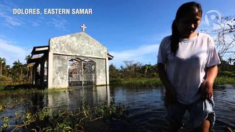
Effects of ruby in dolores eastern samar
Dolores is a third class municipality in the province of Eastern Samar, Philippines. According to the 2015 census, it has a population of 42,866 people.
Contents
- Effects of ruby in dolores eastern samar
- Map of Dolores Eastern Samar Philippines
- History
- Barangays
- Demographics
- References
Map of Dolores, Eastern Samar, Philippines
Dolores is a coastal town bounded on the east by the Pacific Ocean in the Eastern Visayas region of the Philippines. It has many beaches and small islands. Most of the populace speak and understand English.
History
In 1948, the barrios of Can-avid, Carolina, Barok, Cansangaya, Mabuhay, Camantang, Canilay, Pandol and Balagon, formerly part of this town, were separated into the municipality of Can-avid, Eastern Samar, by virtue of Republic Act No. 264.
Barangays
Dolores is politically subdivided into 46 barangays.
Demographics
The population of Dolores in the 2015 census was 42,866 people, with a density of 140 inhabitants per square kilometre or 360 inhabitants per square mile.