Girish Mahajan (Editor)

Timeline of the 1998 Atlantic hurricane season

Updated on
Edit
Like
Comment
Share on FacebookTweet on TwitterShare on LinkedInShare on Reddit
Timeline of the 1998 Atlantic hurricane season

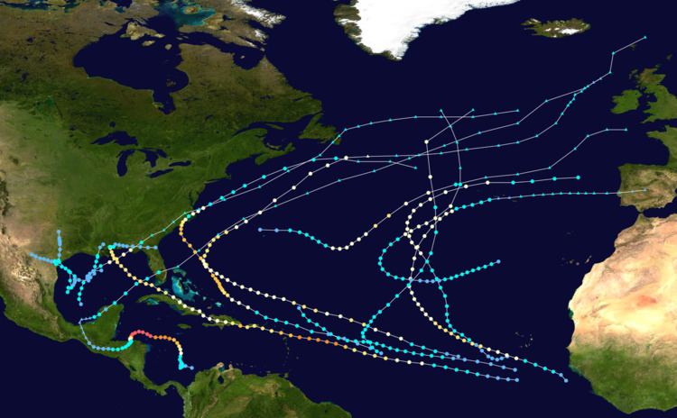
The 1998 Atlantic hurricane season was an average Atlantic hurricane season in which twelve named storms formed. Although Tropical Storm Alex formed on July 27, the season officially began on June 1 and ended on November 30, dates that conventionally delimit the period of each year when most tropical cyclones develop in the Atlantic basin. The final storm, Hurricane Nicole, lasted until December 1, one day after the official end of the season.

Contents

The season produced fourteen tropical depressions, all of which intensified into tropical storms, ten became hurricanes, and three became major hurricanes. The two most significant storms of the season, in terms of loss of life and damage, were hurricanes Georges and Mitch. The former traveled across much of the Greater and Lesser Antilles and made landfall in Mississippi as a Category 2 hurricane. Resulting in extensive damage and a large number of fatalities. Hurricane Mitch's slow movement over Central America caused catastrophic flooding, making it the second deadliest Atlantic tropical cyclone on record.

This timeline includes information that was not operationally released, meaning that data from post-storm reviews by the National Hurricane Center, such as a storm that was not operationally warned upon, has been included. This timeline documents tropical cyclone formations, strengthening, weakening, landfalls, extratropical transitions, and dissipations during the season.

June

June 1
  • 0000 UTC (8:00 p.m. EDT May 31) – The 1998 Atlantic hurricane season officially begins.
  • No tropical cyclones form in the Atlantic Ocean during the month of June.
  • July

    July 27
  • 1200 UTC (8:00 a.m. EDT) – Tropical Depression One develops from a tropical wave while located about 345 miles (555 km) south-southwest of Cape Verde.
  • July 29
  • 0000 UTC (8:00 p.m. AST July 28) – Tropical Depression One strengthens into Tropical Storm Alex.
  • July 31
  • 0000 UTC (8:00 p.m. July 30) – Tropical Storm Alex attains its peak intensity with maximum sustained winds of 50 mph (85 km/h) and a minimum barometric pressure of 1,000 mbar (30 inHg).
  • August

    August 2
  • 1800 UTC (2:00 p.m. AST) – Tropical Storm Alex weakens back to a tropical depression.
  • August 3
  • 0000 UTC (8:00 p.m. AST August 2) – Tropical Depression Alex dissipates 320 miles (510 km) northeast of Saint Martin.
  • August 19
  • 1200 UTC (8:00 a.m. AST) – Tropical Depression Two develops from a tropical wave while located several hundred miles east of the Leeward Islands.
  • August 20
  • 1200 UTC (8:00 a.m. AST) – Tropical Depression Two strengthens into Tropical Storm Bonnie.
  • August 21
  • 0600 UTC (1:00 a.m. CDT) – Tropical Depression Three develops about 315 miles (505 km) southeast of the south Texas coast.
  • 1800 UTC (1:00 p.m. CDT) – Tropical Depression Three strengthens into Tropical Storm Charley.
  • August 22
  • 0000 UTC (8:00 p.m. AST August 21) – Tropical Storm Bonnie strengthens into a Category 1 hurricane.
  • 0600 UTC (1:00 a.m. CDT) – Tropical Storm Charley attains its peak intensity with maximum sustained winds of 70 mph (110 km/h) and a minimum barometric pressure of 1,000 mbar (30 inHg).
  • 1000 UTC (5:00 a.m. CDT) – Tropical Storm Charley makes landfall near Port Aransas, Texas with winds of 45 mph (70 km/h).
  • 1800 UTC (2:00 p.m. AST) – Hurricane Bonnie strengthens to a Category 2 hurricane.
  • 1800 UTC (1:00 p.m. CDT) – Tropical Storm Charley weakens to a tropical depression.
  • August 23
  • 1200 UTC (8:00 a.m. AST) – Hurricane Bonnie strengthens to a Category 3 hurricane.
  • August 24
  • 0000 UTC (7:00 p.m. CDT August 23) – Tropical Depression Charley dissipates over Texas near the Rio Grande.
  • 0000 UTC (8:00 p.m. EDT August 23) – Hurricane Bonnie attains its peak intensity with maximum sustained winds of 115 mph (185 km/h) and a minimum barometric pressure of 954 mbar (28.2 inHg).
  • 0600 UTC (2:00 a.m. AST) – Tropical Depression Four develops from a tropical wave while located about 600 miles (970 km) west-southwest of Cape Verde.
  • 1800 UTC (2:00 p.m. AST) – Tropical Depression Four strengthens into Tropical Storm Danielle.
  • August 25
  • 1200 UTC (8:00 a.m. AST) – Tropical Storm Danielle strengthens to a Category 1 hurricane.
  • August 26
  • 0600 UTC (2:00 a.m. AST) – Hurricane Danielle strengthens to a Category 2 hurricane. Simultaneously, Danielle attains its maximum sustained wind speed of 105 mph (165 km/h).
  • 1800 UTC (2:00 p.m. AST) – Hurricane Danielle weakens to a Category 1 hurricane.
  • August 27
  • 0000 UTC (8p.m. EDT August 26) – Hurricane Bonnie weakens to a Category 2 hurricane.
  • 0400 UTC (12:00 a.m. EDT) – Hurricane Bonnie makes landfall near Wilmington, North Carolina with winds of 110 mph (175 km/h).
  • 0600 UTC (2:00 a.m. AST) – Hurricane Danielle restrengthens to a Category 2 hurricane.
  • 1200 UTC (2:00 a.m. AST) – Hurricane Danielle again attains its maximum sustained winds of 105 mph (165 km/h).
  • 1200 UTC (8 a.m. EDT) – Hurricane Bonnie weakens to a Category 1 hurricane.
  • 1800 UTC (2 p.m. EDT) – Hurricane Bonnie weakens to a tropical storm.
  • August 28
  • 0000 UTC (8:00 p.m. EDT August 27) – Hurricane Danielle weakens to a Category 1 hurricane.
  • 0000 UTC (8:00 p.m. EDT August 27) – Tropical Storm Bonnie restrengthens to a Category 1 hurricane.
  • 1800 UTC (2:00 p.m. EDT) – Hurricane Bonnie weakens to a tropical storm.
  • August 30
  • 1800 UTC (2:00 p.m. EDT) – Tropical Storm Bonnie transitions into an extratropical cyclone while centered south of Newfoundland.
  • August 31
  • 1200 UTC (8:00 a.m. AST) – Hurricane Danielle restrengthens to a Category 2 hurricane. Simultaneously, Danielle attains its maximum sustained wind speed of 105 mph (165 km/h).
  • 1200 UTC (7:00 a.m. CDT) – Tropical Depression Five develops from a tropical wave in the Gulf of Mexico roughly halfway between Mérida and Tampico, Mexico.
  • 1800 UTC (1:00 p.m. CDT) – Tropical Depression Five strengthens into Tropical Storm Earl.
  • September

    September 2
  • 0600 UTC (2:00 a.m. AST) – Hurricane Danielle weakens to a Category 1 hurricane.
  • 1200 UTC (7:00 a.m. CDT) – Tropical Storm Earl strengthens into a Category 1 hurricane.
  • 1800 UTC (1:00 p.m. CDT) – Hurricane Earl strengthens into a Category 2 hurricane. Simultaneously, Earl attains its maximum sustained wind speed of 100 mph (155 km/h).
  • September 3
  • 0000 UTC (7:00 p.m. CDT September 2) – Hurricane Earl weakens to a Category 1 hurricane. Simultaneously, Earl attains its minimum barometric pressure of 985 mbar (29.1 inHg).
  • 0600 UTC (1:00 a.m. AST) – Hurricane Earl makes landfall near Panama City, Florida with winds of 80 mph (130 km/h).
  • 0600 UTC (2:00 a.m. AST) – Hurricane Danielle attains its minimum barometric pressure of 960 mbar (28 inHg).
  • 1200 UTC (7:00 a.m. CDT) – Hurricane Earl weakens to a tropical storm.
  • 1800 UTC (1:00 p.m. CDT) – Tropical Storm Earl transitions into an extratropical cyclone over Georgia.
  • September 4
  • 0000 UTC (8:00 p.m. AST September 3) – Hurricane Danielle transitions into an extratropical cyclone while centered 230 miles (370 km) south of Cape Race, Newfoundland.
  • September 8
  • 1800 UTC (1:00 p.m. CDT) – Tropical Depression Six develops from a broad area of low pressure while located about 160 miles (260 km) east-southeast of Brownsville, Texas.
  • September 9
  • 1800 UTC (1:00 p.m. CDT) – Tropical Depression Six strengthens into Tropical Storm Frances.
  • September 11
  • 0000 UTC (7:00 p.m. CDT September 10) – Tropical Storm Frances attains its maximum sustained wind speed of 65 mph (100 km/h).
  • 0600 UTC (1:00 a.m. CDT) – Tropical Storm Frances attains its minimum pressure of 994 mbar (29.4 inHg). Simultaneously, Tropical Storm Frances makes landfall in Corpus Christi, Texas with winds of 50 mph (85 km/h).
  • September 12
  • 0000 UTC (7:00 p.m. CDT September 11) – Tropical Storm Frances weakens to a tropical depression.
  • September 13
  • 1800 UTC (1:00 p.m. CDT) – Tropical Depression Frances dissipates over northern Texas.
  • September 15
  • 1200 UTC (8:00 a.m. AST) – Tropical Depression Seven develops from a tropical wave while located about 300 miles (480 km) south-southwest of Cape Verde.
  • September 16
  • 1200 UTC (8:00 a.m. AST) – Tropical Depression Seven strengthens into Tropical Storm Georges.
  • September 17
  • 1200 UTC (7:00 a.m. CDT) – Tropical Depression Eight develops from a tropical wave while located in the north-central Gulf of Mexico.
  • 1800 UTC (2:00 p.m. AST) – Tropical Storm Georges strengthens into a Category 1 hurricane.
  • September 18
  • 1200 UTC (8:00 a.m. AST) – Hurricane Georges strengthens into a Category 2 hurricane.
  • September 19
  • 0000 UTC (8:00 p.m. AST September 18) – Tropical Depression Nine develops from a tropical wave while located about 200 miles (320 km) southwest of Cape Verde.
  • 1200 UTC (7:00 a.m. AST) – Tropical Depression Eight strengthens into Tropical Storm Hermine.
  • 1200 UTC (8:00 a.m. AST) – Hurricane Georges strengthens into a Category 3 hurricane.
  • 1800 UTC (2:00 p.m. AST) – Hurricane Georges strengthens into a Category 4 hurricane.
  • September 20
  • 0000 UTC (7:00 p.m. CDT September 19) – Tropical Storm Hermine attains its peak intensity with maximum sustained winds of 45 mph (75 km/h) and a minimum barometric pressure of 999 mbar (29.5 inHg).
  • 0500 UTC (12:00 a.m. AST) – Tropical Storm Hermine makes landfall near Cocodrie, Louisiana with winds of 40 mph (65 km/h).
  • 0600 UTC (2:00 a.m. AST) – Hurricane Georges attains its peak intensity with winds of 155 mph (250 km/h) and a minimum pressure of 937 mbar (27.7 inHg).
  • 1200 UTC (7:00 a.m. CDT) – Tropical Storm Hermine weakens to a tropical depression.
  • 1800 UTC (2:00 p.m. AST) – Tropical Depression Nine strengthens into Tropical Storm Ivan.
  • 1800 UTC (1:00 p.m. CDT) – Tropical Depression Hermine dissipates over southern Mississippi.
  • September 21
  • 0000 UTC (8:00 p.m. AST September 20) – Hurricane Georges weakens to a Category 3 hurricane.
  • 0400 UTC (12:00 a.m. AST) – Hurricane Georges makes landfall near Falmouth, Antigua with winds of 115 mph (185 km/h).
  • 0600 UTC (2:00 p.m. AST) – Tropical Depression Ten develops from a tropical wave while located about 160 miles (260 km) southwest of the coast of Guinea-Bissau.
  • 0800 UTC (4:00 a.m. AST) – Hurricane Georges makes landfall near Basseterre, St. Kitts with winds of 115 mph (185 km/h).
  • 1800 UTC (2:00 p.m. AST) – Tropical Depression Ten strengthens into Tropical Storm Jeanne.
  • 2200 UTC (6:00 p.m. AST) – Hurricane Georges makes landfall near Fajardo, Puerto Rico with winds of 115 mph (185 km/h).
  • September 22
  • 1230 UTC (8:30 a.m. AST) – Hurricane Georges makes landfall near Santo Domingo, Dominican Republic with winds of 120 mph (195 km/h).
  • 1800 UTC (2:00 p.m. AST) – Tropical Storm Jeanne strengthens into a Category 1 hurricane.
  • 1800 UTC (2:00 p.m. AST) – Hurricane Georges weakens to a Category 2 hurricane.
  • September 23
  • 0000 UTC (8:00 p.m. AST September 22) – Hurricane Georges weakens to a Category 1 hurricane.
  • 1200 UTC (8:00 a.m. AST) – Tropical Depression Eleven develops from a low pressure area while located about 55 miles (89 km) west-northwest of Bermuda.
  • 1800 UTC (2:00 p.m. AST) – Tropical Storm Ivan strengthens into a Category 1 hurricane.
  • 1800 UTC (2:00 p.m. AST) – Hurricane Jeanne strengthens into a Category 2 hurricane.
  • 2130 UTC (5:30 p.m. AST) – Hurricane Georges makes landfall near Guantanamo Bay, Cuba with winds of 75 mph (120 km/h).
  • September 24
  • 0000 UTC (8:00 p.m. AST September 23) – Tropical Depression Eleven strengthens into Tropical Storm Karl.
  • 1800 UTC (2:00 p.m. AST) – Hurricane Jeanne attains its peak intensity with maximum sustained winds of 105 mph (170 km/h) and a minimum barometric pressure of 969 mbar (28.6 inHg).
  • September 25
  • 0600 UTC (2:00 a.m. AST) – Hurricane Georges restrengthens to a Category 2 hurricane.
  • 1200 UTC (2:00 p.m. AST) – Tropical Storm Karl strengthens into a Category 1 hurricane.
  • 1530 UTC (11:30 a.m. EDT) – Hurricane Georges makes landfall in Key West, Florida with winds of 105 mph (165 km/h).
  • 1800 UTC (2:00 p.m. AST) – Hurricane Jeanne weakens to a Category 1 hurricane.
  • September 26
  • 0600 UTC (2:00 a.m. AST) – Hurricane Ivan attains its peak intensity with maximum sustained winds of 90 mph (150 km/h) and a minimum barometric pressure of 975 mbar (28.8 inHg).
  • September 27
  • 0000 UTC (8:00 p.m. AST September 26) – Hurricane Karl strengthens into a Category 2 hurricane. Simultaneously, Karl attains its peak intensity with maximum sustained winds of 105 mph (170 km/h) and a minimum barometric pressure of 970 mbar (29 inHg).
  • 0000 UTC (8:00 p.m. AST September 26) – Hurricane Ivan weakened to a tropical storm.
  • 0600 UTC (2:00 a.m. AST) – Tropical Storm Ivan transitions into an extratropical cyclone while north of the Azores.
  • 1200 UTC (2:00 p.m. AST) – Hurricane Karl weakens to a Category 1 hurricane.
  • September 28
  • 0000 UTC (8:00 p.m. AST September 27) – Hurricane Karl weakens to a tropical storm.
  • 0600 UTC (2 a.m. AST) – Tropical Storm Karl transitions into an extratropical cyclone to the west-northwest of the Azores.
  • 1130 UTC (6:30 a.m. CDT) – Hurricane Georges makes landfall in Biloxi, Mississippi with winds of 105 mph (165 km/h).
  • 1800 UTC (1 p.m. CDT) – Hurricane Georges weakens to a Category 1 hurricane.
  • September 29
  • 0000 UTC (7:00 p.m. CDT September 28) – Hurricane Georges weakens to a tropical storm.
  • 1200 UTC (7:00 a.m. CDT) – Tropical Storm Georges weakens to a tropical depression.
  • 1800 UTC (2:00 p.m. AST) – Hurricane Jeanne weakens to a tropical storm.
  • October

    October 1
  • 0000 UTC (8:00 p.m. AST September 30) – Tropical Storm Jeanne weakens to a tropical depression.
  • 0600 UTC (2:00 a.m. AST) – Tropical Depression Jeanne transitions into an extratropical cyclone while nearing the Azores.
  • 1200 UTC (8:00 a.m. EDT) – Tropical Depression Georges dissipates near Jacksonville, Florida.
  • October 5
  • 0000 UTC (8:00 p.m. AST October 4) – Tropical Depression Twelve develops from a tropical wave while located about halfway between Cape Verde and the Lesser Antilles.
  • 0600 UTC (2:00 a.m. AST) – Tropical Depression Twelve strengthens into Tropical Storm Lisa.
  • October 9
  • 1200 UTC (8:00 a.m. AST) – Tropical Storm Lisa strengthens into a Category 1 hurricane. Simultaneously, Lisa attains its peak intensity with maximum sustained winds of 75 mph (120 km/h) and a minimum barometric pressure of 995 mbar (29.4 inHg).
  • October 10
  • 0000 UTC (8:00 p.m. AST October 9) – Hurricane Lisa transitions into an extratropical cyclone while located well to the east of Newfoundland.
  • October 22
  • 0000 UTC (8:00 p.m. AST October 21) – Tropical Depression Thirteen develops from a tropical wave while located about 415 miles (660 km) south of Kingston, Jamaica.
  • 1800 UTC (2:00 p.m. EST) – Tropical Depression Thirteen strengthens into Tropical Storm Mitch.
  • October 24
  • 0600 UTC (2:00 a.m. EST) – Tropical Storm Mitch strengthens into a Category 1 hurricane.
  • 1800 UTC (8:00 p.m. EST) – Hurricane Mitch strengthens into a Category 2 hurricane.
  • October 25
  • 0000 UTC (8:00 p.m. EST October 24) – Hurricane Mitch strengthens into a Category 3 hurricane.
  • 1200 UTC (8:00 a.m. EST) – Hurricane Mitch strengthens into a Category 4 hurricane.
  • October 26
  • 1200 UTC (8:00 a.m. EST) – Hurricane Mitch strengthens into a Category 5 hurricane.
  • 1800 UTC (2:00 p.m. EST) – Hurricane Mitch attains its peak intensity with winds of 180 mph (285 km/h) and a minimum pressure of 905 mbar (26.7 inHg).
  • October 28
  • 0600 UTC (1:00 a.m. CDT) – Hurricane Mitch weakens to a Category 4 hurricane.
  • 1800 UTC (1:00 p.m. CDT) – Hurricane Mitch rapidly weakens to a Category 2 hurricane.
  • October 29
  • 0600 UTC (1:00 a.m. CDT) – Hurricane Mitch weakens to a Category 1 hurricane.
  • 1200 UTC (7:00 a.m. CDT) – Hurricane Mitch makes landfall near La Ceiba, Honduras with winds of 80 mph (130 km/h).
  • 1800 UTC (1:00 p.m. CDT) – Hurricane Mitch weakens to a tropical storm.
  • October 31
  • 1800 UTC (1:00 p.m. CDT) – Tropical Storm Mitch weakens to a tropical depression.
  • November

    November 2
  • 0000 UTC (7:00 p.m. CDT November 1) – Tropical Depression Mitch degenerates into an area of low pressure near the border of Mexico and Guatemala.
  • November 3
  • 1800 UTC (1:00 p.m. CDT) – The area of low pressure regenerated into Tropical Storm Mitch over the Bay of Campeche.
  • November 4
  • 0200 UTC (9:00 p.m. CDT November 3) – Tropical Storm Mitch makes landfall on the Yucatan Peninsula near Campeche, Campeche with winds of 40 mph (65 km/h).
  • 0600 UTC (1:00 a.m. CDT) – Tropical Storm Mitch weakens to a tropical depression over the Yucatan Peninsula.
  • 1200 UTC (7:00 a.m. CDT) – Tropical Depression Mitch re-strengthens into a tropical storm.
  • November 5
  • 1100 UTC (7:10 a.m. EDT) – Tropical Storm Mitch makes landfall near Naples, Florida with winds of 65 mph (100 km/h).
  • 1200 UTC (8:00 a.m. EDT) – Tropical Storm Mitch transitions into an extratropical cyclone near Grand Bahama.
  • November 24
  • 0000 UTC (8:00 p.m. AST) – Tropical Depression Fifteen develops from a strong frontal low pressure area while located about 725 miles (1,165 km) south of Lajes, Azores.
  • 0600 UTC (2:00 a.m. AST) – Tropical Depression Fifteen strengthens into Tropical Storm Nicole.
  • November 26
  • 1200 UTC (8:00 a.m. AST) – Tropical Storm Nicole weakens to a tropical depression.
  • November 27
  • 1800 UTC (2:00 p.m. AST) – Tropical Depression Nicole re-strengthens into a tropical storm.
  • November 30
  • 0000 UTC (8:00 p.m. AST November 29) – The 1998 Atlantic hurricane season officially ends.
  • 0000 UTC (8:00 p.m. AST) – Tropical Storm Nicole strengthens into a Category 1 hurricane.
  • December

    December 1
  • 0000 UTC (8:00 p.m. AST November 30) – Hurricane Nicole attains its peak intensity with maximum sustained winds of 85 mph (140 km/h) and a minimum barometric pressure of 979 mbar (28.9 inHg).
  • 1200 UTC (8:00 a.m. AST) – Hurricane Nicole weakens back to a tropical storm.
  • 1800 UTC (2:00 p.m. AST) – Tropical Storm Nicole transitions into an extratropical cyclone while centered west of the Azores.
  • References

    Timeline of the 1998 Atlantic hurricane season Wikipedia