
Time zone AST (UTC−4) Population 3.736 million (2009) | Demonym(s) Lesser Antillean Area 14,364 km² | |
 | ||
Island States 21 Anguilla (UK) Antigua and Barbuda Aruba (NL) Barbados Bonaire (NL) British Virgin Islands (UK) Caribbean Netherlands Curaçao (NL) Dominica Grenada Guadeloupe (FR) Martinique (FR) Montserrat (UK) Saint Barthélemy (FR) Saint Kitts and Nevis Saint Lucia Saint Martin (FR) Saint Vincent and the Grenadines Sint Maarten (NL) Trinidad and Tobago United States Virgin Islands (US) Islands Points of interest La Grande Soufrière, Fort Christian, Magens Bay, Zoo de Guadeloupe au Parc d, Trunk Bay | ||
The Lesser Antilles (also known as the Caribbees) are a group of islands in the Caribbean Sea. Most form a long, partly volcanic island arc between the Greater Antilles to the north-west and the continent of South America. The islands form the eastern boundary of the Caribbean Sea with the Atlantic Ocean. Together, the Lesser Antilles and the Greater Antilles compose the Antilles (or the Caribbean in its narrowest definition). When combined with the Lucayan Archipelago, all three are known as the West Indies.
Contents
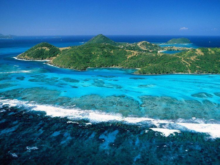
- Map of Lesser Antilles
- Geography
- Geological formation
- Political divisions
- Non sovereign statescountries and territories
- Islands
- Leeward Islands
- Windward Islands
- Leeward Antilles
- References
Map of Lesser Antilles
Geography
The islands of the Lesser Antilles are divided into three groups: the Windward Islands in the south, the Leeward Islands in the north, and the Leeward Antilles in the west.
The Windward Islands are so called because they were more windward to sailing ships arriving in the New World than the Leeward Islands, given that the prevailing trade winds blow east to west. The trans-Atlantic currents and winds that provided the fastest route across the ocean brought these ships to the rough dividing line between the Windward and Leeward Islands.
The Leeward Antilles consist of the Dutch ABC islands just off the coast of Venezuela, plus a group of Venezuelan islands.
Geological formation
The Lesser Antilles more or less coincide with the outer edge of the Caribbean Plate. Many of the islands were formed as a result of the subduction of oceanic crust of the South American Plate under the Caribbean Plate in the Lesser Antilles subduction zone. This process is ongoing and is responsible not only for many of the islands, but also for volcanic and earthquake activity in the region. The islands along the South American coast are largely the result of the interaction of the South American Plate and the Caribbean Plate which is mainly strike-slip, but includes a component of compression.
Political divisions
The Lesser Antilles are divided into eight independent nations and numerous dependent and non-sovereign states (which are politically associated with the United Kingdom, France, the Netherlands, and the United States). Over one third of the total area and population of the Lesser Antilles lies within Trinidad and Tobago, a sovereign nation comprising the two southernmost islands of the Windward Island chain.
Non-sovereign states/countries and territories
Several islands along the north coast of Venezuela and politically part of that country are also occasionally considered part of the Lesser Antilles. These are listed in the section below.
Islands
The main Lesser Antilles are (from north to south to west):
Leeward Islands
Windward Islands
Leeward Antilles
Islands north of the Venezuelan coast (from west to east):