
Country Portugal Area 2,346 km² | Population 105.87 / km2 | |
Points of interest Monte Brasil, Algar do Carvão, São Sebastião, São Pedro Islands São Miguel Island, Terceira Island, Pico Island, Faial Island, Flores Island | ||
The Azores ( ?-ZORZ, AY-zorz; Portuguese: , ), officially the Autonomous Region of the Azores (), is one of the two autonomous regions of Portugal, composed of nine volcanic islands situated in the North Atlantic Ocean about 1,360 km (850 mi) west of continental Portugal, about 880 km (550 mi) northwest of Madeira, and about 1,925 km (1,196 mi) southeast of Newfoundland. Its main industries are agriculture, dairy farming (for cheese and butter products primarily), livestock ranching, fishing, and tourism, which is becoming the major service activity in the region. In addition to this, the government of the Azores employs a large percentage of the population directly or indirectly in many aspects of the service and tertiary sectors.
Contents
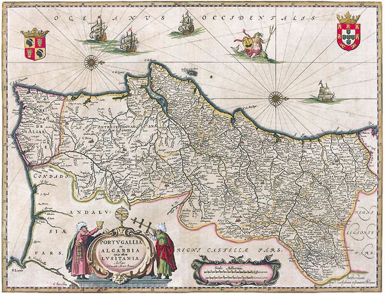
- Map of Azores
- The volcanic mystic in the azores top ten places to travel
- Hiking trails in the azores top ten places to travel
- History
- Geography
- Culture
- Food and drink in the azores
- Eating lapas limpet clam from pico island in the azores cuisine
- References
Map of Azores
There are nine major Azorean islands and an islet cluster, in three main groups. These are Flores and Corvo, to the west; Graciosa, Terceira, São Jorge, Pico, and Faial in the centre; and São Miguel, Santa Maria, and the Formigas Reef to the east. They extend for more than 600 km (370 mi) and lie in a northwest-southeast direction.
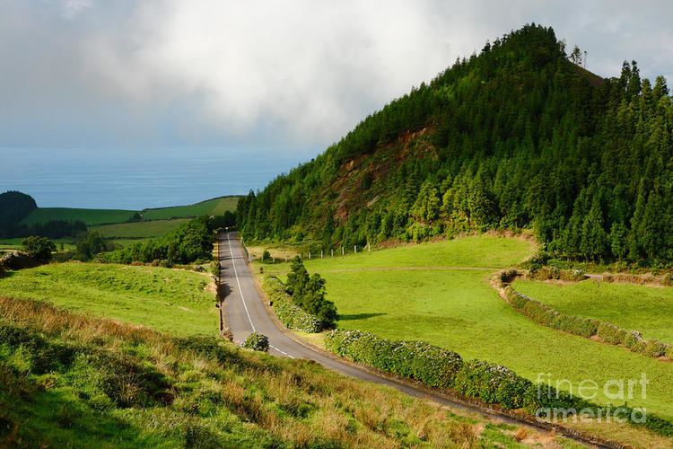
The volcanic mystic in the azores top ten places to travel
All the islands have volcanic origins, although some, such as Santa Maria, have had no recorded activity since the islands were settled. Mount Pico, on the island of Pico, is the highest point in Portugal, at 2,351 m (7,713 ft). The Azores are actually some of the tallest mountains on the planet, measured from their base at the bottom of the ocean to their peaks, which thrust high above the surface of the Atlantic.
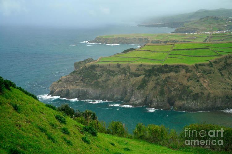
Hiking trails in the azores top ten places to travel
Because these once-uninhabited and remote islands were settled sporadically over a span of two centuries, their culture, dialect, cuisine, and traditions vary considerably.
History
A small number of alleged Hypogea, earthen structures carved into rocks that were used for burials, have been identified on the islands of Corvo, Santa Maria and Terceira by Portuguese archaeologist Nuno Ribeiro and speculations were published that they might date back 2000 years, alluding to a human presence on the island before the Portuguese. However, these kinds of structures have always been used in the Azores to store cereals, and suggestions by Ribeiro that they might be burial sites are unconfirmed. Detailed examination and dating to authenticate the validity of these speculations is lacking. So far, it is unclear whether these structures are natural or man-made and whether they predate the 15th-century Portuguese colonization of the Azores. Solid confirmation of a pre-Portuguese human presence in the archipelago has not yet been published.
Geography
The archipelago of the Azores is located in the middle of the northern hemisphere of the Atlantic Ocean and extends along a west-northwest to east-southeast orientation (between 36.5°–40° North latitudes and 24.5°–31.5° West longitudes) in an area approximately 600 kilometres (373 miles) wide. The islands of the Azores emerged from what is called the Azores Platform, a 5.8 million km2 region that is morphologically accented by a depth of 2000 meters.
From a geostructural perspective the Azores is located above an active triple junction between three of the worlds large tectonic plates (the North American Plate, the Eurasian Plate and the African Plate), a condition that has translated into the existence of many faults and fractures in this region of the Atlantic. The westernmost islands of the archipelago (Corvo and Flores) are located in the North American Plate, while the remaining islands are located within the boundary that divides the Eurasian and African Plates.
The principal tectonic structures that exist in the region of the Azores are the Mid-Atlantic Ridge, the Terceira Rift, the Azores Fracture Zone and the Glória Fault. The Mid-Atlantic Ridge is the main frontier between the American Plate and the African-Eurasian Plates that crosses the Azores Platform between the islands of Flores and Faial from north to south then to the southwest; it is an extensive form crossed by many transform faults running perpendicular to its north-south orientation, that is seismically active and susceptible to volcanism. The Terceira Rift is a system of fractures that extends from the Mid-Atlantic Ridge to the Glória Fault that represents the main frontier between the Eurasian and African Plates. It is defined by a line of submarine volcanoes and island mounts that extend northwest to southeast for about 550 kilometres (342 miles), from the area west of Graciosa until the islets of the Formigas, that includes the islands of Graciosa, Terceira and São Miguel. Its northwest limit connects to the Mid-Atlantic Ridge, while the southeast section intersects the Gloria Fault southeast of the island of Santa Maria. The Azores Fracture Zone is that extends from the Glória Fault and encompasses a relatively inactive area to the south of the islands of the Central and Eastern groups north to the Terceira Rift, along a 45° angle. The Glória Fault, for its part, extends 800 kilometres (497 miles) along a linear line from the Azores to the Azores-Gibraltar Transform Fault.
The islands volcanism is associated with the rifting along the Azores Triple Junction; the spread of the crust along the existing faults and fractures has produced many of the active volcanic and seismic events, while supported by buoyant upwelling in the deeper mantle, some associate with an Azores hotspot. Most of the volcanic activity has centered, primarily, along the Terceira Rift. From the beginning of the islands settlement, around the 15th century, there have been 28 registered volcanic eruptions (15 terrestrial and 13 submarine). The last significant volcanic eruption, the Capelinhos volcano (), occurred off the coast of the island of Faial (in 1957); the most recent volcanic activity occurred in the seamounts and submarine volcanoes off the coast of Serreta and in the Pico-São Jorge Channel. The islands have many examples of volcano-built geomorphology including many of the caves and subterranean lava tubes (such as the Gruta das Torres, Algar do Carvão, Gruta do Natal, Gruta das Cinco Ribeiras), the coastal lava fields (like the coast of Feteiras, Faial, the Mistério of Prainha or São João on Pico Island) in addition to the currently inactive cones in central São Miguel Island, the aforementioned Capelinhos on Faial, the volcanic complexes of Terceira or Plinian caldeira of Corvo Island.
The islands of the archipelago were formed through volcanic and seismic activity during the Neogene Period; the first embryonic surfaces started to appear in the waters of Santa Maria during the Miocene epoch (from circa 8 million years ago). The sequence of the island formation has been generally characterized as: Santa Maria (8.12 Ma), São Miguel (4.1 Ma), Terceira (3.52 Ma), Graciosa (2.5 Ma), Flores (2.16 Ma), Faial (0.7 Ma), São Jorge (0.55 Ma), Corvo (0.7 Ma) and the youngest, Pico (0.27 Ma). Although all islands have experienced volcanism during their geological history, within recorded "human settlement" history the islands of Santa Maria, Flores, Corvo and Graciosa have not experienced any volcanic eruptions; in addition to active fumaroles and hot-springs, the remaining islands have had sporadic eruptions since the 14th century. Apart from the Capelinhos volcano in 1957–58, the last recorded instance of "island formation" occurred off the coast of São Miguel, when the island of Sabrina was briefly formed.
Owing to its geodynamic environment, the region has been center of intense seismic activity, particularly along its tectonic boundaries on the Mid-Atlantic Ridge and Terceira Rift. Seismic events although frequent, usually tectonic or vulco-tectonic in nature, but in general low to medium intensities, occasionally punctuated by events of level 5 or greater on the Richter scale. The most severe earthquake was registered in 1757, near Calheta on the island of São Jorge, which exceeded 7 on the Richter scale. In comparison, the 1522 earthquake, mentioned by Gaspar Frutuoso the historian, was only a magnitude 6.8, but a level 10 on the Mercalli scale, but responsible for the destruction of Vila Franca do Campo and landslides that may have killed less than 5000 of the inhabitants.
The nine islands that comprise the archipelago occupy a surface area of 2,346 km2 (906 sq mi), that includes both the main islands and many islets located in their vicinities. Each of the islands have their own distinct geomorphological characteristics that make them unique: Corvo (the smallest island) is a crater of a major Plinian eruption; Flores (its neighbor on the North American Plate) is a rugged island carved by many valleys and escarpments; Faial characterized for its shield volcano and caldera (Cabeço Gordo); Pico, is the highest point, at 2,351 meters (7,713 ft), in the Azores and continental Portugal; Graciosa is known for its active Furnas do Enxofre and mixture of volcanic cones and plains; São Jorge is a long slender island, formed from fissural eruptions over thousands of years; Terceira, almost circular, is the location of one of the largest craters in the region; São Miguel is the largest island, and is pitted with many large craters and fields of spatter cones; and Santa Maria, the oldest island, is heavily eroded, being one of the few places to encounter brown sandy beaches in the archipelago. They range in surface area from the largest, São Miguel, at 759 km2 (293 sq mi) to the smallest, Corvo, at approximately 17 km2 (7 sq mi).
These islands have naturally evolved into three recognizable groups located within the Azores Platform and they are:
In addition, several sub-surface reefs (particularly the Dollabarat on the fringe of the Formigas), banks (specifically the Princess Alice Bank and D. João de Castro Bank, as well as many hydrothermal vents and sea-mounts are monitored by the regional authorities, owing to the complex geotectonic and socioeconomic significance within the economic exclusion zone of the archipelago.
Culture
Azoreans have developed their own distinct regional identity and cultural traits, from a combination of continental Portuguese customs brought by various waves of immigration and local political and environmental factors.
Religious festivals, patron saints and traditional holidays mark the Azorean calendar. The most important religious events are tied with the festivals associated with the Cult of the Holy Spirit, commonly referred to as the festivals of the Holy Spirit (or Espírito Santo), rooted in millenarian dogma and held on all islands from May to September. These festivals are very important to the Azorean people, who are primarily Roman Catholic, and combine religious rituals with processions celebrating the benevolence and egalitarianism of neighbours. These events are centred around treatros or impérios, small buildings that host the meals, adoration and charity of the participants, and used to store the artefacts associated with the events. On Terceira, for example, these impérios have grown into ornate buildings painted and cared for by the local brotherhoods in their respective parishes. The events focus on the members of local parishes, not tourists, but all are welcome, as sharing is one of the main principles of the festivals. Some limited events focus on tourists, including a public event that the city government of Ponta Delgada on the island of São Miguel holds, which attracts visitors and locals.
Another event, the Festival of Senhor Santo Cristo dos Milagres (Lord Holy Christ of Miracles) in Ponta Delgada on the island of São Miguel, is the largest individual religious event in the Azores, and takes place on the fifth Sunday after Easter. Pilgrims from within the Portuguese diaspora normally travel to Ponta Delgada to participate in an afternoon procession behind the image of Christ along the flower-decorated streets of the city. Although the solemn procession is only held on one day, the events of the Festival of Senhor Santo Cristo occur over a period of a week and involve a ritual of moving the image between the main church and convent nightly, ultimately culminating in the procession, which is televised within the Azores and to the Portuguese diaspora. The Sanjoaninas Festivities in Angra do Heroísmo on Terceira are held in June honoring S. Antonio, S. Pedro and S. João, in a large religious celebration.
The festival of Nossa Senhora de Lourdes, (Our Lady of Lourdes), patron saint of whalers, begins in Lajes on Pico on the last Sunday of August and runs through the week—Whalers Week. It is marked by social and cultural events connected to the tradition of whale hunting. The Festa das Vindimas, (Wine Harvest Festival), takes place during the first week of September and is a century-old custom of the people of Pico.
On Corvo the people celebrate their patron saint Nossa Senhora dos Milagres (Our Lady of Miracles) on 15 August every year in addition to the festivals of the Divine Holy Spirit. The Festival da Maré de Agosto (August Sea Festival), takes place every year beginning on 15 August in Praia Formosa on Santa Maria. Also, the Semana do Mar (Sea Week), dedicated almost exclusively to water sports, takes place in August in the city of Horta, on Faial.
Carnaval is also celebrated in the Azores. Parades and pageants are the heart of the Carnaval festivities. There is lively music, colorful costumes, hand-made masks, and floats. The traditional bullfights in the bullring are ongoing as is the running of bulls in the streets.