
Interest Biological Location map Magic Map Area 143 ha | Grid reference TL344400 Notification 1984 Elevation 168 m Phone +44 7847 485953 | |
 | ||
Hours Open today · Open 24 hoursThursdayOpen 24 hoursFridayOpen 24 hoursSaturdayOpen 24 hoursSundayOpen 24 hoursMondayOpen 24 hoursTuesdayOpen 24 hoursWednesdayOpen 24 hoursSuggest an edit Similar Ivinghoe Beacon, Pavis Wood, Rowley's Hill, Haddington Hill, Little Trees Hill | ||
Therfield heath dji phantom 3 standard
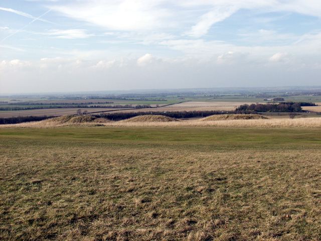
Therfield Heath is a biological Site of Special Scientific Interest and Local Nature Reserve on the chalk escarpment just north of Therfield, Hertfordshire; since it lies south-west of the town of Royston it is also known locally as Royston Heath. The Heath is a common on which sheep are still regularly grazed. The site offers views towards the north, over the valley of the Cam as far as Cambridge.
Contents
The heath contains a long barrow, thought to be neolithic, and several bronze age round barrows, all of which English Heritage classes as scheduled ancient monuments. The round barrow cemetery is the largest known example of its type in Hertfordshire. Therfield heath was reportedly favoured by king James I as a hunting ground.
The highest point of the Heath is Therfield Hill. This top reaches 168 m (551 ft), the highest point for twelve miles in every direction with a relative height of about 72 m. The top is crowned by a water tower. Church Hill has many rare pasqueflowers, which flower in early spring.
The Heath can be accessed from Baldock Road.