
Existed: before 1939 – present Length 230.6 km | SH 104 SH 105 → | |
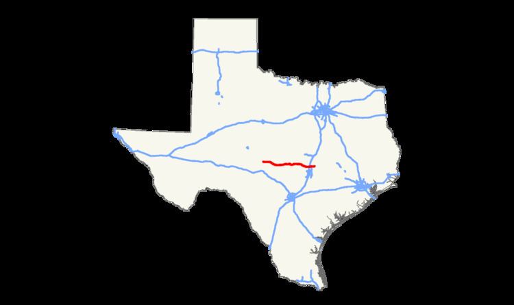 | ||
State Highway 29, or SH 29, runs from 3.0 miles (4.8 km) south of Menard, Texas, east to SH 95 in Circleville (6.0 miles north of Taylor) via Mason, Llano, Burnet, Liberty Hill, and Georgetown in central Texas, United States.
Contents
Map of TX-29, Texas, USA
In Georgetown, SH 29 is known as University Avenue and is the main east–west artery through the city, passing in front of Southwestern University, which has been on the same road since its Georgetown campus opened in 1873.
An open house meeting at East View High School in Georgetown was held on September 1, 2015. The meeting's purpose was to review the upcoming plans on widening SH 29 from 2 lanes (80 ft.) to 6 lanes (160 ft.). Construction will not start until after the Summer of 2016 and will occur from Southwestern Blvd extending all the way to Hwy 95 in Circleville, TX.
Previous routes
SH 29 was proposed by 1919 on a route from Port O'Connor to Austin. By 1926, it had been extended north and west along the previous SH 20, with a proposed ending in Rocksprings. By 1935, the southern portion had been shifted significantly, now travelling through Goliad and Refugio, ending near Gregory along portions of proposed routes SH 190 and SH 119. The original route became an extension of SH 27. In 1951, the stretch from Liberty Hill to Gregory was reassigned to U.S. Highway 183, with SH 29 routed farther east along former SH 104 from Liberty Hill to Circleville, and was also extended west from Mason along former SH 151 to Eldorado. In 1977, the section from Eldorado to Menard was redesignated U.S. Highway 190, shortening SH 29 to its current designation.
SH 29A was a proposed spur route splitting at Luling and travelling northwest through San Marcos to Blanco. By 1926, it had been renumbered SH 80. It was reassigned on a new spur route from Mason to Menard. By 1931, this had been renumbered as SH 151.
US 83 to Burnet
SH 29 begins at an interchange with US 83 south of Menard. SH 29 travels east to Mason, where it begins an overlap with US 377 west of town. The two highways travel into town together where at US 87 SH 29 separates from US 377 and heads south on US 87 for about 1/4 mile before separating and heading east towards Llano. West of Llano, SH 29 begins an overlap with SH 71 that lasts until SH 16 in Llano. Leaving Llano, SH 29 travels on the south side of Buchanan Lake traveling near the Buchanan Dam. Less than a mile after the dam, SH 29 crosses the Colorado River/Inks Lake. The highway then heads towards Burnet, where it intersects US 281.
Burnet to SH 95
Leaving Burnet, SH 29 travels through the towns of Bertram and Liberty Hill before intersecting US 183 at Seward Junction north of Leander. SH 29 then arrives in Georgetown, where it intersects I-35 and serves as the south boundary for Southwestern University. On the east side of town, SH 29 intersects SH 130 then travels through unincorporated Williamson County before ending at SH 95 north of Taylor.