
Existed: by 1933 – present East end: SH 21 Length 101.5 km | West end: SH 7 SH 293 SH 294 → | |
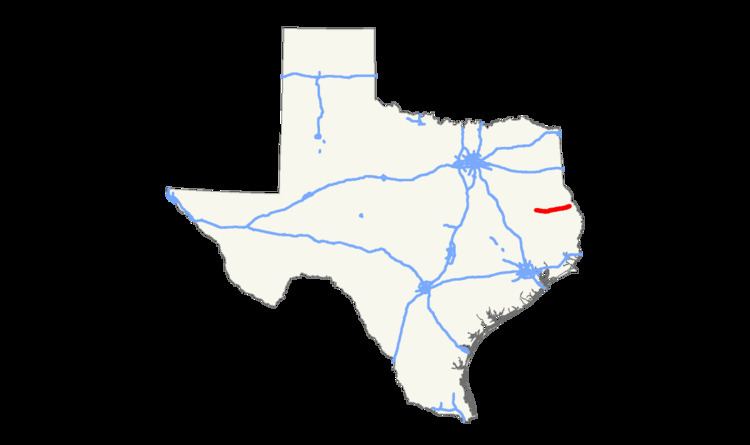 | ||
State Highway 103, or SH 103, is a state highway that runs through east Texas from an intersection with SH 7 near the Neches River through Lufkin to an intersection with SH 21 near the Louisiana state border. The route was originally designated in 1926.
Contents
Map of TX-103, Texas, USA
Route description
SH 103 begins at an intersection with SH 7 just east of the Neches River. It then travels generally eastward to the western outskirts of Lufkin. The route then briefly travels northeast along State Loop 287 and US Route 69 before entering Lufkin coinciding with the business route of US 69. At Atkinson Drive, it turns east and proceeds out of town. It crosses two arms of Lake Sam Rayburn before reaching its eastern terminus at SH 21 just west of Milam, and 10 miles from the Louisiana border. The entire route covers 63.05 miles.
History
SH 103 was originally designated in 1926 from Centerville east through Crockett to Lufkin, replacing a section of SH 7, which was truncated further to the north. By 1933, the route has only been built between Crockett and Ratcliff, and was only an improved earth road. By 1940, sections around Lufkin were completed, but did not connect to earthen roads to the west. In 1941 the western end from Centerville to Radcliff was reassigned to SH 7, which was shifted to the south. The entire routing was completed by the late 1940s, which the duplication from Radcliff east to the Neches River was removed in 1961.