
Country United States County Bowie Time zone Central (CST) (UTC-6) Local time Wednesday 9:42 PM | Elevation 299 ft (91 m) ZIP codes 755XX. | |
 | ||
Weather 19°C, Wind S at 10 km/h, 91% Humidity Points of interest Spring Lake Park, Draughn‑Moore House, Discovery Place Children, Museum of Regional History, Texarkana Museums System | ||
Texarkana is a city in Bowie County, Texas, United States, located in the Ark-La-Tex region. It is a twin city with neighboring Texarkana, Arkansas. The population of the Texas city was 36,411 at the 2010 census. The city and its Arkansas counterpart form the core of the Texarkana Metropolitan Statistical Area, encompassing all of Bowie County, Texas, and Miller County, Arkansas. The two cities had a combined population of 66,330 at the 2010 census, and the metropolitan area had a total population of 136,027.
Contents
- Map of Texarkana TX USA
- History
- Geography
- Climate
- Demographics
- Economy
- Local government
- Public school districts
- Colleges and universities
- Religion
- State government
- Federal government
- Transportation
- Notable people
- References
Map of Texarkana, TX, USA
History
Railroads were quick to see the possibilities of this vast area, and in the late 1850s the builders of the Cairo and Fulton Railroad were pushing their line steadily across Arkansas. By 1874, they had crossed the Red River and had reached the Texas state line. Between February 16 and March 19, 1874, trains ran between the Texas border and the Red River, whence passengers and freight were ferried to Fulton to continue by rail. The Red River Bridge opened on March 20, 1874, and since then trains have run directly from Texarkana to St. Louis.
There was keen rivalry between the 1870s railroad builders. The Texas and Pacific Railroad reached across Texas to the Arkansas state line. The border was the logical place for the different railways to connect. On December 8, 1873, the Texas and Pacific sold the first town lots for the future city. First to buy was J.W. Davis, who purchased the land where today's Hotel McCartney now stands, opposite Union Station.
It is not known who gave Texarkana its name. A popular story credits Colonel Gus Knobel, who surveyed the Iron Mountain Railroad right-of-way from Little Rock to this section to the state line. He allegedly painted "TEX-ARK-ANA" on a plank and nailed it to a tree, saying, "This is the name of a town which is to be built here."
Miller County, on the Arkansas side of the metropolitan area, is probably the only county in the United States that was abolished, only to be reestablished later. Miller County was formed in 1820 to honor James Miller who was Arkansas' first governor. Miller County was formed with a large degree of uncertainty as to the location of the line dividing the county and the Mexican boundary. Consequently, settlers felt that Arkansas levied and collected taxes on land that eventually might be held by Mexico. Moreover, many who resented the oppression of Texans by the Mexicans were openly declaring allegiance to the Texans. This led to general unrest, and after the Texas Republic was created, it grew worse. So, in 1838, Governor James Conway proposed that the "easiest and most effective remedy is the abolition of Miller County to an area which is more patriotic." From that year until 1874, it was a part of Lafayette County, Arkansas. Its re-establishment sprung only from the sale of town lots in Texarkana in 1873. Efforts of the young town to be incorporated were not realized until October 17, 1880, nearly seven years after Texarkana, Texas (June 12, 1874) was formed. December 8, 1873, is generally recognized by both cities as the date of organization.
Geography
Texarkana is located at the junction of Interstate 30 and US highways 59, 67, 71, and 82 in extreme northeast Texas on the Texas-Arkansas border, at 33°26′14″N 94°4′3″W (33.437170, -94.067394). It is bordered by the city of Texarkana, Arkansas, to the east, and by the smaller cities of Nash and Wake Village, Texas, to the west. It is in the Central Time Zone.
According to the United States Census Bureau, the Texas city has a total area of 29.5 square miles (76.3 km2), of which 29.0 square miles (75.2 km2) is land and 0.42 square miles (1.1 km2), or 1.39%, is water. The city is roughly 180 miles northeast of Dallas.
Climate
On the evening of May 22, 2008 a microburst producing winds up to 100 mph occurred over Stateline Avenue and surrounding communities. An analysis of radar data leading up to the damage showed that two severe thunderstorms came together on the south side of the city. One severe storm was moving northeastward from Southern Bowie County while the other was moving northwestward through Miller County. Both storms collided in an area just south of Downtown Texarkana.
Demographics
As of the census of 2000, there were 34,782 people, 13,569 households, and 8,941 families residing in the city. The population density was 1,357.3 people per square mile (524.0/km²). There were 15,105 housing units at an average density of 589.4 per square mile (227.5/km²). The racial makeup of the city was 59.18% White, 37.05% African American, 0.34% Native American, 0.73% Asian (U.S. Census), 0.05% Pacific Islander, 1.43% from other races and 1.22% from two or more races. Hispanic or Latino of any race were 2.91% of the population.
There were 13,569 households out of which 31.5% had children under the age of 18 living with them, 42.5% were married couples living together, 19.3% have a female householder with no husband present and 34.1% were non-families. 29.9% of all households were made up of individuals and 12.1% had someone living alone who was 65 years of age or older. The average household size was 2.42 and the average family size was 3.01.
In the city, the age distribution of the population shows 26.0% under the age of 18, 10.0% from 18 to 24, 27.6% from 25 to 44, 20.7% from 45 to 64, and 15.7% who were 65 years of age or older. The median age was 36 years. For every 100 females there were 89.0 males. For every 100 females age 18 and over, there were 84.4 males.
The median income for a household in the city was $29,727, and the median income for a family was $38,505. Males had a median income of $34,155 versus $21,143 for females. The per capita income for the city was $17,815. About 19.4% of families and 24.0% of the population were below the poverty line, including 34.8% of those under age 18 and 13.2% of those age 65 or over. The most affluent area of Texarkana is Pleasant Grove, where the median income is $49,562 for each household and the median for a family is $57,219 in 2013.
Economy
According to the city's 2009 Comprehensive Annual Financial Report, the top employers in the city are:
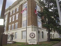
Local government
According to the city's most recent Comprehensive Annual Financial Report Fund Financial Statements, the city's various funds had $36.0 million in revenues, $37.0 million in expenditures, $18.9 million in total assets, $3.5 million in total liabilities, and $7.2 million in investments.
The structure of the management and coordination of city services is:
Public school districts
Schools in Texarkana, Texas are under the jurisdiction of the Texarkana Independent School District, the Liberty-Eylau Independent, Pleasant Grove Independent School District, and the Red Lick Independent School District.
Colleges and universities
Texarkana is home to Texas A&M University–Texarkana, a four-year branch of the Texas A&M University System, and to Texarkana College, a community college.
Religion
Texarkana is the headquarters of the theologically conservative American Baptist Association, whose Missionary Baptist churches are most numerous in Texas, Arkansas, Louisiana, Oklahoma, and Mississippi.
State government
Though the city was historically Democratic, Texarkana is currently represented by Republicans in both houses of the Texas State Legislature. The state senator is Bryan Hughes from District 1. State Representative Gary VanDeaver represents Texas House District 1.
The Texas Department of Criminal Justice (TDCJ) operates the Texarkana District Parole Office in Texarkana.
The Texas Sixth Court of Appeals is located downtown in the Bi-State Justice Building.
Federal government
At the federal level, the two U.S. senators from Texas are Republicans John Cornyn and Ted Cruz; Texarkana is part of Texas's 4th congressional district, which is currently represented by Republican John Ratcliffe.
The Federal Courthouse (which also holds the downtown post office) is located directly on the Arkansas-Texas state line and is the only federal office building to straddle a state line. During his campaign for the presidency in 1960. John F. Kennedy spoke on the steps of the courthouse.
The Federal Correctional Institution, Texarkana, is a Federal Bureau of Prisons facility in unincorporated Bowie County just outside the southwest border of the city.
Transportation
Texarkana Regional Airport is located in Texarkana, Arkansas, and serves general aviation and American Eagle service to Dallas/Fort Worth International Airport.
Texarkana Union Station is located in downtown Texarkana along the state line, with daily Amtrak service west to Los Angeles via Dallas, San Antonio, and El Paso and east to Chicago via Little Rock and St. Louis.
The Texarkana Urban Transit District provides bus transportation to major areas of town along nine different routes. Service runs from 5:30 am to 6:20 pm Monday - Saturday.
Interstate 30 passes through Texarkana on the north. Loop 151 on the west of the city forms part of the Texarkana Loop, a three-quarter loop around the west, south and east of the twin cities with I-30 completing the loop on the north. Interstate 369 shares the western portion of Loop 151. Interstate 49 is a newly constructed interstate corridor on the Arkansas side of the city which connects Texarkana to Shreveport, Louisiana.