
Country Japan - Flower Rhododendron obtusum Population 76,560 (Feb 2015) | Region Kantō Area 60.97 km² Local time Monday 6:01 PM | |
 | ||
Weather 9°C, Wind W at 29 km/h, 56% Humidity | ||
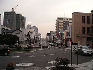
Tatebayashi (館林市, Tatebayashi-shi) is a city located in southeastern Gunma Prefecture in the northern Kantō region of Japan. As of February 2015, the city had an estimated population of 75,560 and a population density of 1260 persons per km². Its total area was 60.97 km². Tatebayashi is famous for Azalea Hill Park and Bunbuku Chagama of Morinji Temple.
Contents
- Map of Tatebayashi Gunma Prefecture Japan
- Geography
- Surrounding municipalities
- History
- Economy
- Education
- University
- Railway
- Highway
- Local attractions
- Sister city relations
- Notable people
- References
Map of Tatebayashi, Gunma Prefecture, Japan
Geography
Tatebayashi is located in the extreme southeastern portion of Gunma Prefecture in the Kantō Plains, bordered by Tochigi Prefecture to the north. The Tone River and Watarase Rivers pass through the city.
Surrounding municipalities
History
During the Edo period, the area of present-day Tatebayashi was a castle town and administrative center of Tatebayashi Domain, a feudal domain under the Tokugawa shogunate in Kōzuke Province.
Tatebayashi Town was created within Ōra District, Gunma Prefecture on April 1, 1889 with the creation of the municipalities system after the Meiji Restoration. On April 1, 1954 the town of Tatebayashi and the villages of Satoya, Ōshima, Akabane, Rokugō, Minoya, Tatara, and Watarase merged to form the city Tatebayashi.
There is a small community of around 200 Rohingya from Myanmar living in Tatebayashi.
Economy
Tatebayashi is a regional commercial center and transportation hub. Food processing dominates the manufacturing sector of the local economy.
Education
There are two public and one private high school, five public middle schools and 11 public elementary schools in Tatebayashi