
 | ||
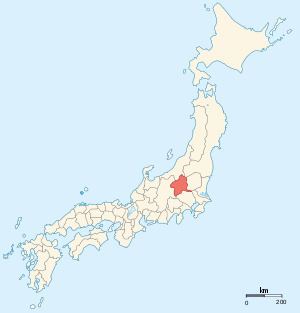
Kōzuke Province (上野国, Kōzuke-no kuni) was a province of Japan in the area of Japan that is today Gunma Prefecture. Kōzuke bordered by Echigo, Shinano, Musashi and Shimotsuke Provinces. Its abbreviated form name was Jōshū (上州). Under the Engishiki classification system, Kōzuke was ranked as one of the 13 "great countries" (大国) in terms of importance, and one of the 30 "far countries" (遠国) in terms of distance from the capital. The provincial capital is located in what is now the city of Maebashi; however, its exact location remains uncertain. The Ichinomiya of the province is located in what is now the city of Tomioka.
Contents
History
During the 4th century AD, (Kofun period) the area of modern Gunma and southern Tochigi prefectures were known as Keno or Kenu (毛野). At some unknown point in the 5th century, the area was divided at the Kinugawa River into Kamitsuteno (上毛野) and Shimotsuteno (下毛野). Per the Nara period Taihō Code, these provinces became Kamitsuteno-no-kuni (上毛野国) and Shimotsuteno-no-kuni (下毛野国). In 713, with the standardization of province names into two kanji, these names became Kōzuke (上野) and Shimozuke (下野).
From the Heian period, from the year 811, Kōzuke (along with Hitachi and Kazusa) was one of the three provinces where an Imperial Prince was designated as nominal ruler. The area was noted for its production of horses. The original capital of the province was located in what is now Maebashi, along with the kokubun-ji and the sōja of the province. The ichinomiya was located in what is now the city of Tomioka.
During the Sengoku period, Kōzuke was contested between the late Hōjō clan, the Takeda and the Uesugi clans. After the establishment of the Tokugawa Shogunate, much of the province was assigned to several feudal domains. The Nakasendō and the Mikuni Kaidō highways passed through the province, and numerous post stations were established.
Following the Meiji restoration, the various domains became prefectures with the abolition of the han system in 1871. These various prefectures merged to form Gunma Prefecture in 1876. The area subsequently prospered with the development of sericulture and silk spinning industries.