
Existed: 1972 – present | Length 679.5 km | |
 | ||
From: Kawaguchi Junction in Kawaguchi, Saitama
Shuto Expressway Kawaguchi Route
Tokyo Gaikan Expressway Major cities Sendai, Utsunomiya, Koriyama, Morioka, Fukushima, Kitakami, Saitama, Hirosaki, Tochigi, Tatebayashi, Kazuno | ||
The Tōhoku Expressway (東北自動車道, Tōhoku Jidōsha-dō) is a national expressway in Japan. It is owned by Japan Expressway Holding and Debt Repayment Agency and operated by East Nippon Expressway Company.
Contents
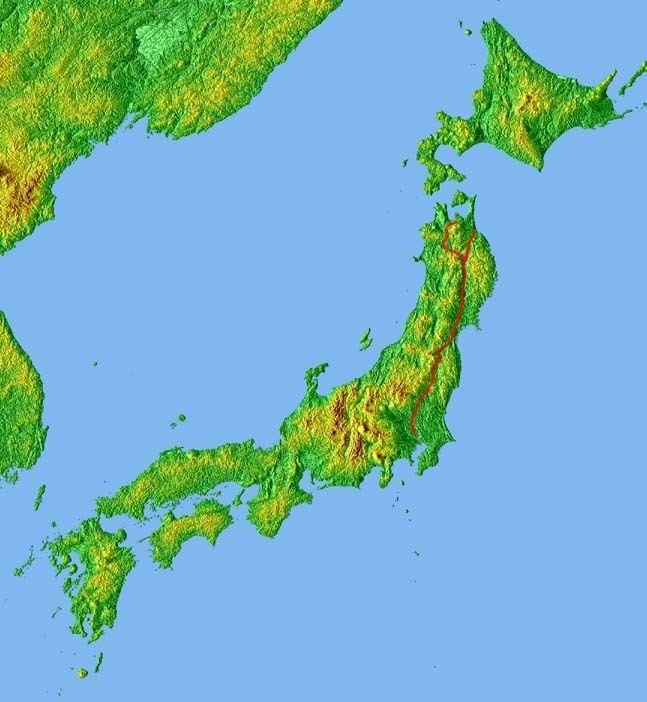
- Map of Tohoku Expressway Japan
- Naming
- Overview
- List of interchanges and features
- Kawaguchi JCT Sendai Miyagi IC
- References
Map of Tohoku Expressway, Japan
Naming
Tōhoku refers to the Tōhoku region, the northernmost region on the island of Honshū.
Officially the expressway is designated as the Tōhoku Jūkan Expressway Hirosaki Route. It is also concurrent with the Tōhoku Jūkan Expressway Hachinohe Route until Ashiro Junction, where it diverges from the Tōhoku Expressway to become the Hachinohe Expressway.
Overview
The expressway links the Tōhoku region with the Kantō region and the greater Tokyo urban area. It is also the longest expressway among all expressways operated by East Nippon Expressway Company.
Starting at a junction with the Tokyo Gaikan Expressway to the north of Tokyo, the expressway follows a northerly course through the plains of Saitama Prefecture and Tochigi Prefecture before entering the mountainous interior of the Tōhoku region. Passing through central Fukushima Prefecture, the expressway then enters Miyagi Prefecture and passes to the west of Sendai, the largest city in the Tōhoku region. The expressway continues north into Iwate Prefecture, passing the prefectural capital Morioka. In the northern part of Iwate, the expressway veers to the northwest, while the Hachinohe Expressway branches off to the northeast. The Tōhoku Expressway continues into central Aomori Prefecture before terminating in the city of Aomori, the prefectural capital.
The route parallels the Tōhoku Shinkansen and Tōhoku Main Line of East Japan Railway Company as well as National Route 4 from the origin to the city of Morioka. North of Morioka the route diverges and parallels the Ōu Main Line and National Route 7 to the terminus in Aomori.
The expressway is 6 lanes from Kawaguchi Junction to Utsunomiya Interchange, and 4 lanes from Utsunomiya to the terminus in Aomori.
Many sections of the expressway were damaged on 11 March 2011 during the 2011 Tōhoku earthquake and tsunami. The expressway reopened on 24 March 2011.