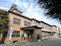
District Ōra - Flower Sakura Population 15,082 (Feb 2015) | Region Kantō Area 41.86 km² Local time Friday 5:52 AM | |
 | ||
Weather 1°C, Wind W at 6 km/h, 70% Humidity Points of interest Raiden Shrine, Itakura Central Park, Tenjinike Park | ||
Itakura (板倉町, Itakura-machi) is a town located in Ōra District, Gunma Prefecture, in the northern Kantō region of Japan. As of February 2015, the town had an estimated population of 11,024 and a population density of 561 persons per km². Its total area was 19.64 km². Itakura's animal mascot is the catfish. It is represented in a bronze statue at Raiden Shrine, as a mikoshi in Itakura's summer festival, and also is emblazoned on the town's manhole covers. Itakura is one of the few places in Japan where catfish is eaten, and it boasts two restaurants specializing in catfish dishes.
Contents
- Map of Itakura Ora District Gunma Prefecture Japan
- Geography
- Surrounding municipalities
- History
- Economy
- Education
- Railway
- Highway
- Local attractions
- References
Map of Itakura, Ora District, Gunma Prefecture, Japan
Geography
Itakura is located in the northern Kantō Plains in the extreme southern corner Gunma prefecture, bordered by Saitama Prefecture to the south and Tochigi Prefecture to the north. The Tone River flows through the town, and the Watarase River forms its northern border.
Surrounding municipalities
History
The villages of Nishiyada, Ebise, Ōgano and Inara were created within Ōra District, Gunma Prefecture on April 1, 1889 with the creation of the municipalities system after the Meiji Restoration. On February 1, 1955, the four villages merged to form the town of Itakura. Meiwa was raised to town status on October 1, 1998.
Economy
Itakura is largely a bedroom community for Tokyo and nearly Tatebayashi. About 55% of the town’s area is farmland, and Itakura's main agricultural products include rice and cucumbers, though many other crops are grown locally.
