
Elevation 1,673 m (5,489 ft) Country Japan | ||
 | ||
Length 40 km (25 mi) East to West Width 20 km (12 mi) North to South Mountains Mount Ōyama, Mount Tō, Mount Tanzawa, Mount Hiru, Hinokihoramaru Similar Mount Tō, Mount Ōyama, Mount Hiru, Lake Tanzawa, Hinokihoramaru | ||
Tanzawa mountains (丹沢山地, Tanzawa-sanchi) are mountain range in the Kantō region, in Japan. It covers the northwestern part of Kanagawa Prefecture and touches the prefectural borders of Shizuoka Prefecture to the west and the Yamanashi Prefecture to the north.
Contents
- Map of Tanzawa yama Miyagase Kiyokawa Aiko District Kanagawa Prefecture 243 0111 Japan
- Mountains
- Hiking
- Fishing
- Sites
- Wildlife and flora
- References
Map of Tanzawa-yama, Miyagase, Kiyokawa, Aiko District, Kanagawa Prefecture 243-0111, Japan
Mountains
Hiking
Climbers come from various parts of Japan, but there have been a growing number of international climbers. The mountain range offers numerous moderate to strenuous trails for hikers. The most popular peaks among climbers are Mount Tō (塔ノ岳) and Mount Ōyama (大山) which are located in the eastern part of the Mountains, mainly due to their easier transportation access from Yabitsu Pass. However, the tallest mountain in these mountains is Mount Hiru, which is 1,673 metres (5,489 ft). In comparison, Mount Tō is 1,491m (4,891 ft) high and Mount Ōyama is 1,252 metres (4,108 ft) high. The western part is less often visited, but offers the opportunity of river trekking or sawanobori (a form of mountaineering).
Fishing
Fishing is another popular activity within the rivers of Tanzawa. Different types of fish can be caught such as trout and yamame.
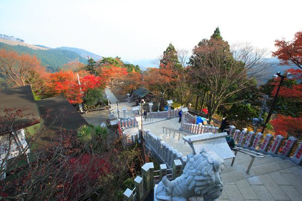
Sites
The Tanzawa Mountains are most accessible by Kanagawa Route 70, which runs between Hadano and Miyagase. The highest point of the route is Yabitsu Pass, approximately 11 km from Hadano. Towards the middle of the route is Kiyokawa Village, which offers lodging, camping, and fishing, and also has a trailhead for hiking the different mountains. Various other campsites can be found along Route 70. Another place of interest is Lake Miyagase, which is man-made and filled with a dam.
Wildlife and flora
The landscape of the Tanzawa Mountains consists of numerous rivers, streams, forests, mountains, valleys, and ridges. Like much of Japan, the moist climate allows for lush vegetation which offers habitats for a variety of wildlife. The forestry is mixed and consisting of nearly half of the trees coniferous and the other half deciduous. The coniferous trees include Japanese cedar (杉) and Hinoki cypress (檜), and are mainly seen in the lower altitudes near the valleys. The deciduous trees include Japanese mountain maple (山紅葉) and Japanese beech, and are more common in the higher altitudes. Various types of flowers can be found throughout the year, such as Rhododendron.
The area is populated with Sika Deer (鹿), Japanese raccoon dog (狸), Japanese flying squirrel and Japanese Serow. There are also hundreds of species of birds such as Kingfisher. Along the river banks, frogs and lizards can be commonly found.