
Native name 高原川 Length 59 km | Basin size 781.6 km (301.8 sq mi) Basin area 781.6 km² Mouth Jinzū River | |
 | ||
Main source Mount Norikura2,751 m (9,026 ft) Discharge Average rate:120 m/s (4,200 cu ft/s) | ||
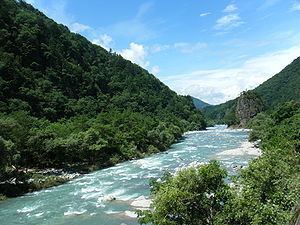
The Takahara River (高原川, Takahara-gawa) has its source at Mount Norikura in the northern part of Gifu Prefecture, Japan, and flows into Toyama Prefecture, where it joins with the Jinzū River. It is a Class 1 River.
Contents
Map of Takahara-gawa, Kamiokacho Nakayama, Hida, Gifu Prefecture, Japan
The river was polluted with cadmium due to mining at the Kamioka mines (神岡鉱山 Kamioka Kōzan) and caused the itai-itai disease in the downstream towns around World War II.
River Communities
The river passes through or forms the boundary of the following communities:
References
Takahara River Wikipedia(Text) CC BY-SA