
Highest point Yuntai Mountain Country China | Mountains Yuntai Mountain | |
 | ||
Similar Yuntai Mountain, Red Flag Canal, Loess Plateau, Mount Wutai, Qilian Mountains | ||
Spiral staircase in taihang mountains china
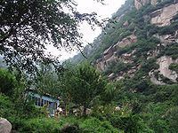
The Taihang Mountains (Chinese: 太行山; pinyin: Tàiháng Shān) are a Chinese mountain range running down the eastern edge of the Loess Plateau in Shanxi, Henan and Hebei provinces. The range extends over 400 kilometres (250 mi) from north to south and has an average elevation of 1,500 to 2,000 metres (4,900 to 6,600 ft). The principal peak is Xiao Wutaishan (2,882 metres (9,455 ft)). Cangyan Shan in Hebei forms the eastern tip of the Taihang range.
Contents
Map of Taihang Shan, Shahe, Xingtai, China
The name of Shanxi Province, meaning "west of the mountains", derives from its location west of the Taihang Mountains, as does the name of Shandong Province (east of the mountains).
The Red Flag Canal is located on the south edge of the Taihang Mountains.
The Shitai Passenger Railway crosses under the Taihang Mountains via the Taihang Tunnel, which, at almost 28 kilometres (17 mi), is the third longest railway tunnel in China.