
Established 1782 Website sylhet.gov.bd Local time Monday 1:42 PM | Time zone BST (UTC+6) Postal code 3100 | |
 | ||
Weather 24°C, Wind NE at 10 km/h, 89% Humidity Points of interest Ratargul Swamp Forest, Dreamland Amusement & Water P, Adventure World Amusem, Museum of Rajas', Osmani Shishu Uddan | ||
Sylhet (Bengali: সিলেট জেলা, Sylhet Jela also Sylhet Zila), located in north-east Bangladesh, is one of the four districts in the Sylhet Division.
Contents
Map of Sylhet District, Bangladesh
History
Sylhet district was established on 3 January 1782, and until 1878 it was part of Bengal province. In that year, Sylhet was included in the newly created Assam Province, and it remained as part of Assam up to 1947 (except during the brief break-up of Bengal province in 1905–11). In 1947, Sylhet became a part of East Pakistan as a result of a referendum (except the sub-division of Karimganj) as part of Chittagong Division. It was subdivided into four districts in 1983-84. It was converted into a Division in 1995.
Geography
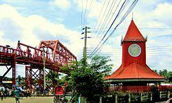
Sylhet is the chief town of the division, where the division headquarters as well as Sylhet district headquarters are located. Its most famous natural touristic spot is Jaflong and it is also home to the grave of the Muslim saint, Hazrat Shah Jalal Yamani, located in Sylhet town.
Subdivisions
Sylhet District is divided into twelve sub-districts or Upazilas.
They are:
Religion
The district of Sylhet has 6,754 mosques, 453 temples, 96 churches and four Buddhist temples.