Country Bangladesh Languages spoken Sylheti, Standard Bengali Area 26.50 km2 | District Sylhet District Mayor Ariful Haque Chowdhury Literacy 88.67% Population 2,675,346 | |
Colleges and Universities Shahjalal University of Science and Technology (Sylhet), Sylhet Agricultural University (Sylhet), Metropolitan University (Sylhet), Murari Chand College (Sylhet), Sylhet International University (Sylhet) Similar Sylhet Division, Chittagong, Khulna | ||

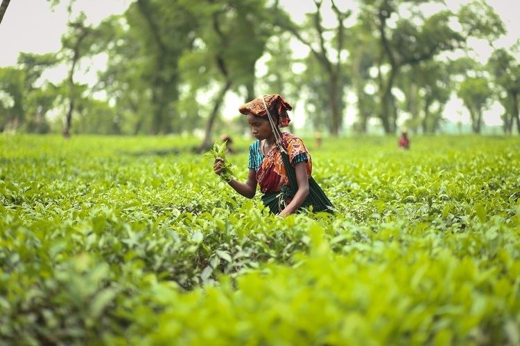
Sylhet (Bengali: , ; historically Shilahatta; also Jalalabad) is a major city that lies on the banks of Surma River in north-east Bangladesh. The city has a population of over 500,000 people. It is surrounded by tea estates, sub-tropical hills, rain forests and river valleys; the region is one of the leading tourist destinations in the country.
Contents
- Map of Sylhet
- History
- Geography and climate
- Economy
- Culture
- Sylhet spice cuisine bangladeshi and indian restaurant
- Albamra shopping centre sylhet fast food
- Sylhet spice cuisine bangladeshi and indian restaurant 20second version
- References
Map of Sylhet
Sylhet is a prominent Islamic spiritual centre and home to numerous Sufi shrines. It hosts the 14th century mausoleums of Shah Jalal and Shah Farhan. The Sylhet municipality was constituted during the British Raj in 1867. It was part of the Bengal Presidency and the Assam Province. Upon a referendum, it became part of East Bengal in the Pakistani Dominion after the Partition of British India in 1947. Sylhet became a focal point for Bengali revolutionaries during the Bangladesh Liberation War in 1971. It was the hometown of General M A G Osmani, the Commander-in-Chief of Bangladesh Forces.
The Sylhet Division produces most of Bangladeshs tea yield and natural gas. It is also known for its cane, citrus, timber and agarwood. Sylhet is a major recipient of remittances from the Bangladeshi diaspora, particularly from the United Kingdom. The city is served by the Osmani International Airport. It is connected to the Port of Chittagong by the N2 and the Bangladesh Railway. The Bangladesh-India border in Tamabil is located to the north of the city. Sylhet is also home to the Shahjalal University of Science and Technology
History
Sylhet was an expanded commercial center from the ancient period, which explains its original namesake. During this time, Sylhet was inhabited by mongoloid tribes though ethnically the population would also have traces of Assamese, Arabs, Persians and Turks. It has also been suggested that the capital cities of the ancient kingdoms of Harikela, Gaur, Srihatta and port city of Kamarupa were situated in modern-day Sylhet.

In the ancient and early medieval period, Sylhet was ruled primarily by local chieftains as viceroy of the kings of Pragjyotishpur. There is evidence to suggest that the Maharaja Sri Chandra, of northern Bengal, conquered Bengal in the 10th century, although this is a much disputed topic amongst Bangladeshi historians and archaeologists. This was a period of relative prosperity and there is little evidence to suggest this was marred by wars or feuds. Sylhet was certainly known by the rest of India, and is even referred to in the ancient Nath sacred Tantric text, the Shakti Sangama Tantra, as Silhatta. The last chieftain to reign in Sylhet was Govinda of Gaur. Sylhet was previously a kingdom of Nath Shampraday, controlled by the rajas. Nath kingdoms of ancient Sylhet declined and tribal people of mongoloid origin established their chiefdoms in most parts of Sylhet. One of such chieftains was Gobindo of Gaur, commonly known as Gor Gobindo, who was defeated in 1303 by Hazrat Shah Jala Yamani and his 360 Sufi disciples.
Geography and climate
Sylhet is located at 24.8917°N 91.8833°E? / 24.8917; 91.8833, in the north eastern region of Bangladesh within the Sylhet Division, within the Sylhet District and Sylhet Sadar Upazila. The climate of Sylhet is humid subtropical with a predominantly hot and humid summer and a relatively cool winter. The city is within the monsoon climatic zone, with annual average highest temperatures of 23 °C (Aug–Oct) and average lowest temperature of 7 °C (Jan). Nearly 80% of the annual average rainfall of 3,334 mm occurs between May and September.

The city is located within the region where there are hills and basins which constitute one of the most distinctive regions in Bangladesh. The physiography of Sylhet consists mainly of hill soils, encompassing a few large depressions known locally as "beels" which can be mainly classified as oxbow lakes, caused by tectonic subsidence primarily during the earthquake of 1762. It is flanked by the Indian states of the Meghalaya in the north, Assam in the east, Tripura in the south and the Bangladesh districts of Netrokona, Kishoregonj and Brahmanbaria in the west. The area covered by Sylhet Division is 12,569 km², which is about 8% of the total land area of Bangladesh.
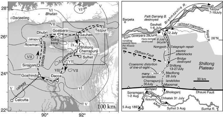
Geologically, the region is complex having diverse sacrificial geomorphology; high topography of Plio-Miocene age such as Khasi and Jaintia hills and small hillocks along the border. At the centre there is a vast low laying flood plain of recent origin with saucer shaped depressions, locally called Haors. Available limestone deposits in different parts of the region suggest that the whole area was under the ocean in the Oligo-Miocene. In the last 150 years three major earthquakes hit the city, at a magnitude of at least 7.5 on the Richter Scale, the last one took place in 1918, although many people are unaware that Sylhet lies on the earthquake prone zone of Bangladesh.
Economy
Remittance has been the key element of the economic growth of the city and also the region. The money is mainly sent by expatriates of Sylhet living abroad, particularly the United Kingdom, where the majority of the diaspora Bangladeshi community originate from Sylhet. These foreign Bangladeshis are now looking to invest in the city. During the fiscal year of 2005–06, the flow of remittances increased by 25% to $4.8 billion, mostly from expatriates of Sylheti origin living in the United Kingdom with significant contributions from expatriates in the United States. That amount was expected to increase to $5.5 billion in 2007, with the governments attention toward supervising and monitoring banks. The amount of idle money lying with the commercial banks in Sylhet as deposits is about 4,000 kuti taka, which is not common in the rest of Bangladesh.
Culture

Given its unique cultural and economic development, and linguistic differences (Greater Sylhet region was a part of Assam and Surma Valley State for much of the British Raj in comparison to the rest of Bangladesh), and given that Sylhet has, for most of its recent history, been a region of a larger entity. As so many Sylhetis are resident abroad, Sylhet has a major flow of foreign currency from non-resident Bangladeshis. The major holidays celebrated in Sylhet include traditional and religious celebrations, Muslim festivals of Ramadan and then after, Eid-ul-Fitr and Eid-ul-Adha. Cultural or nationalistic celebrations include the Language Movement Day, this is where wreaths are laid at the Shaheed Minar paying tribute to the martyrs, the Bangladeshi Independence Day, Victory Day celebrated with parades by school and academies, and the Pohela Baishakh—celebration of the Bengali New Year. Marriages are practised in a traditional Bengali Muslim style, with the gaaye halud, mehendi art and holy prayers.
