
Postal code 3120-3129 Local time Wednesday 1:48 AM | Time zone BST (UTC+6) Area 389.5 km² | |
 | ||
Weather 19°C, Wind E at 3 km/h, 76% Humidity | ||
Balaganj (Bengali: বালাগঞ্জ) upazila is an administrative area in Sylhet, Bangladesh. It is in Sylhet District within Sylhet Division.
Contents
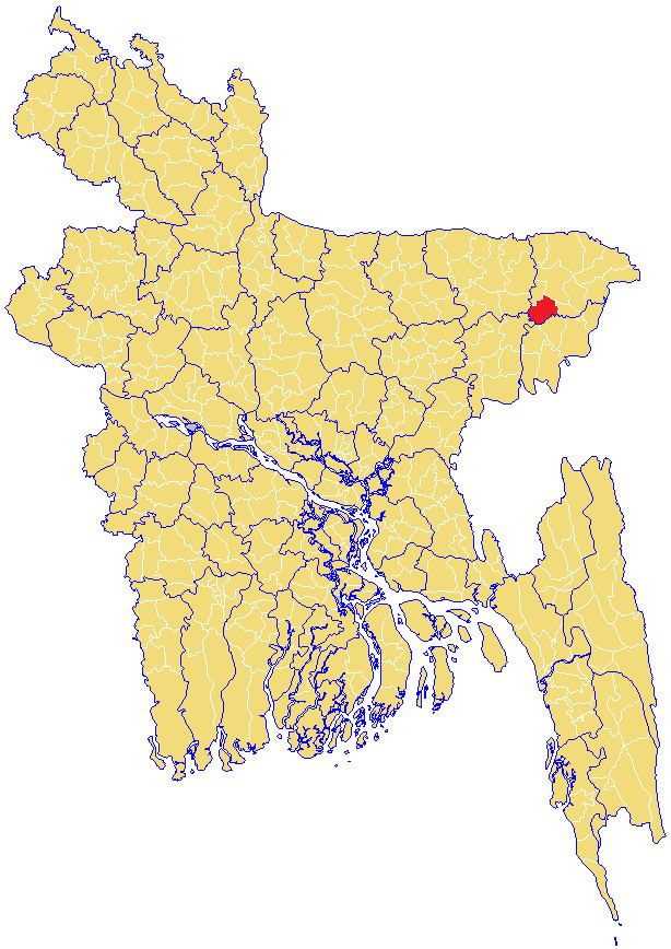
- Map of Balaganj Upazila Bangladesh
- Etymology
- History
- Geography
- Demographics
- Economy
- Emigration
- Administration
- Education
- References
Map of Balaganj Upazila, Bangladesh
Etymology
The name Balaganj is derived from the Sylheti word bala meaning 'good' and the Persian/Bengali word ganj that means 'marketplace' or 'neighbourhood'.
History
Balaganj was the home of M. A. G. Osmani commander-in-chief of the Mukti Bahini during the 1971 Bangladesh Liberation War and was scene of the battles at Sherpur and Sadipur during that conflict. The war dead are buried in mass graves at Aadittapur, Burunga and Vatpara Solimpur.
It is the third largest Upazila of Sylhet zila by population. Balaganj thana was established in 1882 and was turned into an upazila on 10 January 1983. It consists of 14 union parishads, 241 mouzas and 467 villages.
Geography
The Upazila Balaganj stands on the Kushiyara River and is on the southwest periphery of Sylhet district. To the north is Sylhet Sadar Upazila, to the south are Rajnagar Upazila and Moulvibazar Sadar Upazila in Moulvibazar District, Fenchuganj Upazila of this district is on the east and on the west is Bishwanath Upazila of this district and Jagannathpur Upazila of Sunamganj District. Geographically Balaganj Upazila is situated at about 24.36* and 24.47* longitude and 91.38* and 91.56* east latitude. The distance of the Upazila headquarter(HQ) from the district HQ is nearly 37 km. The land area is approximately 375.92 km2
Balaganj is located at 24.6667°N 91.8333°E / 24.6667; 91.8333. It has 36,919 household units and occupies an area of 389.51 km2. The Upazila is bordered on the north by Sylhet Sadar and Bishwanath Upazilas, on the east by Fenchuganj Upazila, on the South by Maulvibazar Sadar Upazila and Rajnagar Upazila of Maulvibazar zila, and on the west by Jagannathpur Upazila of Sunamganj zila and Nabiganj Upazila of Habiganj zila.
Demographics
As of the 1991 Bangladesh census, Balaganj has a population of 230,865. Males constitute 50.67% of the population, and females 49.33%. Muslim 90.04%, Hindu 9.89%, Buddhist, Christian and others 0.07%. This Upazila's eighteen and over population is 115,624. Balaganj has an average literacy rate of 57.4% (7+ years), with the national average being 32.4%. The population is 3,20,227. (Census-2001).
Economy
Main hats, bazars and fairs Balaganj, Goala Bazar, Tajpur Bazar, Doyamir Bazar, Pirer Bazar, Bualjur Bazar, Ilash pur Bazar, Aziz pur Bazar, Goher pur Bazar/Murar Bazar, Madrassa Bazar,Bangla Bazar, Khaler Mukh Hats and Shior Khal Mela are notable.
Main occupations Agriculture 26.04%, service 24.51%, commerce 18.22%, agricultural labourer 11.31%, wage labourer 7.25%, fishing 4.29%, transport 1.97%, others 6.41%
Emigration
Many people from Balaganj have emigrated to the United Kingdom. They have also emigrated to the United States of America, Singapore, France, Spain, Canada and Australia.
Several Balganji migrants to the UK settled in Sussex, Birmingham and London. The Birmingham districts of Aston, Small Heath and Sparkbrook have a sizeable community with Balaganj origins. Balganji immigrants to London are numerous in Bow and Bethnal Green. There are also large concentrations in Cardiff, Wales, and Michigan, Detroit, Los Angeles, Paterson, NJ, Newark, NJ and New York City in the United States.
Administration
Balaganj has 14 Unions/Wards, 240 Mauzas/Mahallas, and 467 villages.
The unions are:
- Balaganj
- Boaljur Bazar
- Burunga
- Dayamir
- Dewan Bazar
- Goula Bazar
- Omarpur
- Osmanpur
- Paschim Gauripur
- Paschim Pailanpur
- Purba Gauripur
- Purba Pailanpur
- Sadipur
- Tajpur
Education
Educational institutions: college 11, secondary school 57, primary school 278, madrasa 44. Goher Pur Jamea Islamia Hussainia Title Madrassa, Islamia Mohammadiya Alim Madrasha, Balaganj Degree College, Taj Pur Degree College, Islamia Mohammadiya Alim Madrasha and Balaganj D.N. High School,D.N. High School was estd. in the year 1946. Dewan Abdur Rahim High School and Aziz Pur High School are notable.