
Primary outflows Shuili River Surface area 7.93 km (3.06 sq mi) Surface elevation 748 m | Basin countries Taiwan Max. depth 27 m (89 ft) Area 7.93 km² Outflow location Shuili River | |
 | ||
Similar Formosan Aboriginal Culture Vi, Qingjing Farm, Taroko National Park, Xiangshan Visitor Center, Lalu Island | ||
The crystal resort sun moon lake taiwan yuchi
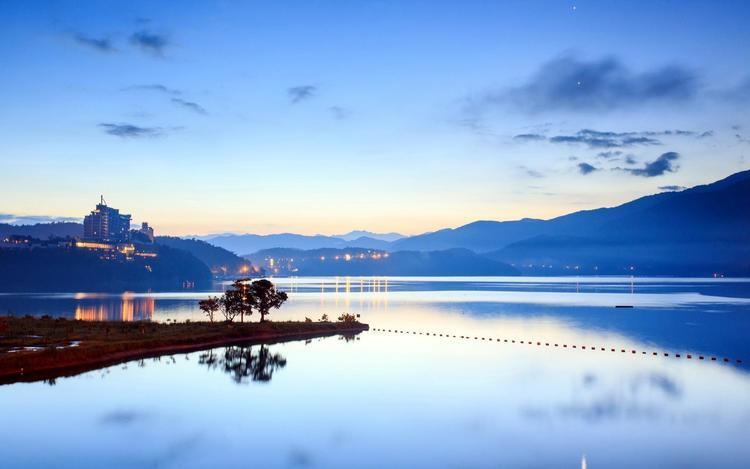
Sun Moon Lake (Chinese: 日月潭; pinyin: Rìyuè tán; Pe̍h-ōe-jī: Ji̍t-goa̍t-thâm; Thao: Zintun) is the largest body of water in Taiwan as well as a tourist attraction. Located in Yuchi Township, Nantou County, the area around the Sun Moon Lake is home to the Thao tribe, one of aboriginal tribes of Taiwan. Sun Moon Lake surrounds a tiny island called Lalu. The east side of the lake resembles a sun while the west side resembles a moon, hence the name.
Contents
- The crystal resort sun moon lake taiwan yuchi
- Map of Sun Moon Lake Yuchi Township Nantou County Taiwan 555
- Overview
- History
- PRC passport
- References
Map of Sun Moon Lake, Yuchi Township, Nantou County, Taiwan 555
Overview
Sun Moon Lake is located 748 m (2,454 ft) above sea level. It is 27 m (89 ft) deep and has a surface area of approximately 7.93 km2 (3.06 sq mi). The area surrounding the lake has many trails for hiking.
While swimming in Sun Moon Lake is usually not permitted, there is an annual 3-km race called the Swimming Carnival of Sun Moon Lake held around the Mid-Autumn Festival each year. In recent years the participants have numbered in the tens of thousands. Other festivities held at the same time include fireworks, laser shows, and concerts.
The lake and its surrounding countryside have been designated one of thirteen national scenic areas in Taiwan. Wen Wu Temple was built after rising water levels from building a dam forced several smaller temples to be removed. Ci En Pagoda (慈恩塔; Cí'ēn Tǎ) was built by late President Chiang Kai-shek in 1971 in memory of his mother. Other temples of note include Jianjing Temple, Syuentzang Temple (玄奘寺; Xuánzàng Sì) and Syuanguang Temple (玄光寺; Xuánguāng Sì).
History
In older English literature it was commonly referred to as Lake Candidius, after the 17th century Dutch missionary Georgius Candidius. In the middle of the lake is the Lalu Island, which is the holy ground for the Thao tribe. In legend, Thao hunters discovered Sun Moon Lake while chasing a white deer through the surrounding mountains. The deer eventually led them to the lake, which they found to be not only beautiful, but abundant with fish. Today, the white deer of legends is immortalized as a marble statue on Lalu Island.
Under Japanese rule, the island was renamed "Jade Island" (Japanese: 玉島). After Chiang Kai-shek's Nationalist Government moved to Taiwan, the island was renamed Kuang-hua Island (Chinese: 光華島; literally: "glorious China island") and in 1978 the local government built a pavilion where annual weddings took place. In 1999, the 921 earthquake destroyed the pavilion and sank most of the island. In recent years, due to increasing social and political awareness, more deference and recognition are being given to Taiwanese aborigines. As a result, after the 921 earthquake, the island was renamed in the Thao language as "Lalu".
Several hydroelectric power plants have been built in the Sun Moon Lake since 1919, including Mingtan Pumped Storage Hydro Power Plant and Minhu Pumped Storage Hydro Power Station. When the first hydroelectric plant was finished in 1934, it was considered to be one of the most important infrastructure constructions of the time. Wujie Dam, also completed in 1934, diverts water from the Zhuoshui River to increase hydroelectric generation at the lake. The Jiji Line railroad was built to facilitate the construction.
PRC passport
The depiction of Sun Moon Lake is featured in the newly issued People's Republic of China passport in 2012, a move that has triggered protest from Taipei to Beijing.