
Length 186 km Basin area 3,157 km² | Discharge 164.8 m³/s Country Taiwan | |
 | ||
- average 164.8 m/s (5,820 cu ft/s) | ||
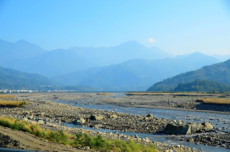
2014 08 17 taiwan history zhuo shui river the longest river in taiwan
The Zhuoshui River, also spelled Choshui River, (Chinese: 濁水溪; Hanyu Pinyin: Zhuóshuǐ Xī; Tongyong Pinyin: Jhuóshuěi Si; Wade–Giles: Cho2-shui3 Hsi1; Pe̍h-ōe-jī: Lô-chúi-khoe) is the longest river in Taiwan. It flows from its source in Nantou County up to the western border of the county, subsequently forming the border between Yunlin County and Changhua County, with a total length of 186 km.
Contents
- 2014 08 17 taiwan history zhuo shui river the longest river in taiwan
- Map of Taiwan E6BF81E6B0B4E6BAAA
- References
Map of Taiwan, %E6%BF%81%E6%B0%B4%E6%BA%AA
The river serves as an unofficial boundary between the north and south of Taiwan. It is dammed in its upper reaches by the Wushoh and Wujie Dams and further downstream by the Chichi Weir.
The Zhuoshui River environment has in recent years been seriously degraded both by the construction of a dam across the river at Jiji and by the ongoing activities of the concrete industry.