
- elevation 69 m (226 ft) - elevation 0 m (0 ft) Length 22 km | - average 50 m/s (1,766 cu ft/s) Basin area 1,463 km² | |
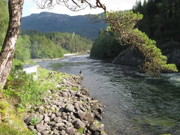 | ||
The Suldalslågen (or locally, Lågen) is a river that is located in the municipality of Suldal in Rogaland county, Norway. The 22-kilometre (14 mi) long river runs from the lake Suldalsvatnet to the southwest to the village of Sand where it empties into the Sandsfjorden. The Norwegian National Road 13 runs along the river, past the villages of Suldal and Sand.
Map of Suldalsl%C3%A5gen, Suldal Municipality, Norway
The Suldalslågen has a natural watershed of 1,463 square kilometres (565 sq mi), of which 75% is above the timber line in high mountain areas, making it western Norway's largest river system. The Suldalslågen and its upstream watercourses are heavily dammed and regulated (including transfer of water across catchment borders) for hydroelectric power generation, and represents about 6% of Norway's total hydroelectric power generation. The upper tributaries of the Suldalslågen are located on the vast Hardangervidda plateau in Odda (in Hordaland county) and Vinje (in Telemark county).
The Suldalslågen one of Norway’s most famous Atlantic salmon rivers, with a fishing history dating back hundreds of years.