
Area rank 12 in Norway Population 3,756 (2004) | Administrative centre Åmot Area 3,106 km² Local time Monday 9:33 PM | |
 | ||
Demonym(s) VinbyggVinbygge (male)Vinbyggje (female) Weather -2°C, Wind W at 5 km/h, 78% Humidity Points of interest | ||
Vinje is a municipality in Telemark county, Norway. It is part of the traditional region of Vest-Telemark. The administrative center of the municipality is the village of Åmot.
Contents
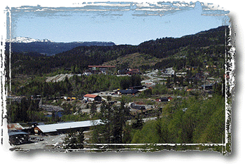
Map of Vinje, Norway
Name
The municipality of Vinje (originally a parish) is named after the old Vinje farm (Old Norse: Vinjar), since the first church was built there. The name is the plural form of vin which means "meadow" or "pasture".
See also Vinje, Sør-Trøndelag.
Coat-of-arms
The coat-of-arms is from modern times. They were granted on 16 November 1990. The arms show a silver goat on a blue background. It is symbolic of the goat and sheep farming in the municipality.
(See also the coat-of-arms for Aurland.)
History
Vinje was established as a municipality on 1 January 1838 (see formannskapsdistrikt). The area of Rauland was separated from Vinje in 1860 to become a municipality of its own. On 1 January 1964 Rauland was merged back into the municipality of Vinje. Rauland has since been part of the larger Vinje municipality. The local traditions of arts and crafts have been well maintained, and Rauland hosts a national academy for arts, crafts and traditional music.
Vinje became a site of heavy battles during World War II, at the Battle of Vinjesvingen when Norwegian forces held out for over a month against superior German forces.
Geography
Vinje is situated on both the Hardangervidda plateau and parts of the Setesdalsheiene mountain plateaus. European route E134 passes through Vinje, which is located halfway between Oslo and Haugesund on Norway’s west coast.
Starting at Haukeli, Norwegian National Road 9 leads up the steep slopes to Hovden and further south down the Setesdal to Kristiansand.
The mountain ski resort Haukelifjell is also found nearby. The isolated and sparsely populated area is known for its rugged, mountainous terrain that supports a wide variety of outdoor activities, amongst them hiking, mountain biking, snowboarding, skiing, fishing, and canoeing.
Arabygdi lies on Lake Totak in the western part of Rauland. Its famous attraction is the "Urdbøuri", the largest stone scree in Northern Europe, with huge boulders scattered on the floor of the valley.