
Airport type Public Elevation AMSL 224 ft / 68 m 5,002 1,525 Elevation 68 m | Owner City of Stuttgart 9/27 5,002 Code SGT Phone +1 870-673-2960 | |
 | ||
Address U.S. Highway 63, Stuttgart, AR 72160, USA Similar Hazen Municipal Airport, Carlisle Municipal Airport, Stuttgart Municipal Water Work, Mayor's Office, Almyra Municipal Airport | ||
Stuttgart Municipal Airport (IATA: SGT, ICAO: KSGT, FAA LID: SGT) is in Prairie County, Arkansas. It is eight miles north of Stuttgart, which owns the airport and is the county seat of Arkansas County. The FAA's National Plan of Integrated Airport Systems for 2009–2013 categorized as a general aviation facility.
Contents
History
Stuttgart Municipal Airport dates to 1942 when it was built by the United States Army Air Forces. It was used as an advanced twin-engine flying school and glider training. With the end of World War II, Stuttgart Army Airfield was declared excess and closed on 5 August 1946. It was conveyed though the War Assets Administration (WAA) to the City of Stuttgart to establish a municipal airport.
Airline flights (Trans-Texas DC-3s) ended in 1958-59.
Facilities
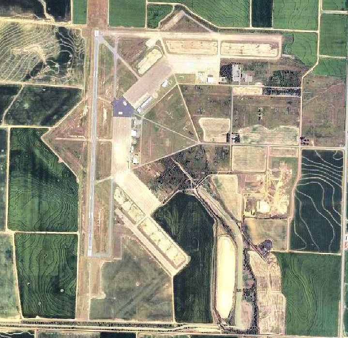
Stuttgart Municipal Airport covers 2,560 acres (1,040 ha) at an elevation of 224 feet (68 m). It has two runways: 9/27 is 5,002 by 150 feet (1,525 x 46 m) concrete; 18/36 is 6,015 by 100 feet (1,833 x 30 m) asphalt.
In the year ending June 30, 2008 the airport had 40,200 aircraft operations, average 110 per day: 87% general aviation, 7.5% military, and 5.5% air taxi. 34 aircraft were then based at the airport: 82% single-engine, 12% multi-engine, 3% jet and 3% helicopter.
Motorsports
A 3-mile (4.8 km) SCCA road course used the runways, with the first race in 1959. The last sports car race was in 1978. A drag strip, Stuttgart Dragway, existed from 1970 to 1972.