Samiksha Jaiswal (Editor)

Steyr Land District

Updated on
Edit
Like
Comment
Share on FacebookTweet on TwitterShare on LinkedInShare on Reddit
Country
  
Austria

Time zone
  
CET (UTC+1)

Number of municipalities
  
21

State
  
Upper Austria

Area
  
971.7 km²

Steyr-Land District httpsuploadwikimediaorgwikipediacommonsthu

Points of interest
  
Enns, Garsten Abbey, Castle of Losenstein, Kletterwald Goldberg, Dambergwarte

Destinations
  
Bad Hall, Enns, Reichraming, Losenstein, Großraming

Bezirk Steyr-Land is a district of the state of Upper Austria in Austria.

Contents

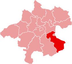
Map of Steyr-Land District, Austria

Municipalities

Towns (Städte) are indicated in boldface; market towns (Marktgemeinden) in italics; suburbs, hamlets and other subdivisions of a municipality are indicated in small characters.

  • Adlwang
  • Aschach an der Steyr
  • Bad Hall
  • Dietach
  • Gaflenz
  • Garsten
  • Großraming
  • Laussa
  • Losenstein
  • Maria Neustift
  • Pfarrkirchen bei Bad Hall
  • Reichraming
  • Rohr im Kremstal
  • Schiedlberg
  • Sierning
  • Sankt Ulrich bei Steyr
  • Ternberg
  • Waldneukirchen
  • Weyer
  • Wolfern
  • References

    Steyr-Land District Wikipedia