Nationality French Died December 6, 1673 Name Guillaume Vasseur | Employer Polish army Years active 1632-1648 Home town Rouen | |
 | ||
Native name Guillaume Levasseur de Beauplan Born 1595 Dieppe, Normandy, Kingdom of France Known for book "Description d'Ukranie" (originally "Description des contres du Royaume de Pologne")maps of UkraineBar FortressBrody CastleKodak Fortress renovations | ||
Guillaume Le Vasseur de Beauplan
Guillaume Levasseur de Beauplan (c. 1600 – 6 December 1673) or William le Vasseur de Beauplan was a French-Polish cartographer, engineer and architect.
Contents
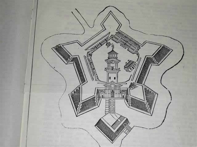
Beauplan served as artillery captain for the army of the Crown of the Kingdom of Poland between 1630 and 1647 or 1648. He was sent to Ukraine where he served under Stanisław Koniecpolski in 1637–38. He used his architectural skills while in the military. In 1639, he was involved in the rebuilding of the Kodak Fortress. He also built a fortress at Bar, worked on Brody Castle, and structures in Kremenchuk.
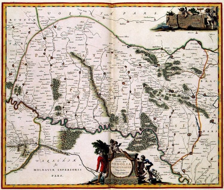
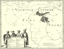
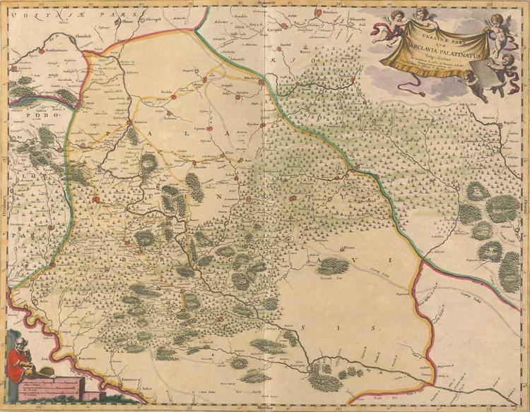
In 1639, Beauplan created the first "descriptive" map of Ukraine. He created a map of Ukraine in 1648 that had detailed border information. By 1654 he was working in Danzig. He created a map with a scale of 1:452,000 and an additional map scaled at 1:1,800,000. Both maps were engraved by Willem Hondius. These maps would go on to be published in Rouen, France and reproduced by Veniiamyn Kordt. Beauplan published another map of the Dnieper River in 1662.
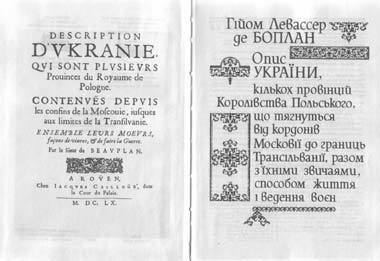
He wrote Description des contrés du Royaume de Pologne, which was published in 1651. It was renamed Description d'Ukranie, when the second edition was released in 1651. Two more editions were published in 1660 and 1861. The book was the first book published that provided a geographical, economic, and demographic description of Ukraine. By 1832 it had been translated into five languages. It remains in print today. In the book, Ukraine was described as a territory between Muscovy and Transylvania.
Publications