
Country State | Languages spoken Gujarati, Hindi | |
 | ||
Map of Songadh
Songadh is a taluka in Tapi district in the Indian state of Gujarat.
Contents
- Map of Songadh
- Songadh ashram ek jhalak gujarati mp4
- Full information about fort of songadh daks
- Geography
- Places of interest in Fort Songadh
- History of Fort
- Neighbouring Towns
- Demographics
- Villages of Songadh Taluka
- References
Songadh ashram ek jhalak gujarati mp4
Full information about fort of songadh daks
Geography
Fort Songadh is located at 21.17°N 73.57°E / 21.17; 73.57. It has an average elevation of 112 metres (367 feet).
The town is located at the foot of a solitary hill, the surrounding area has been almost completely flattened by approximately 30 stone quarries. Due to these stone quarries, its economy has increased to the level of the rest of the state. Songadh's surrounding areas are covered with semi dense forest.
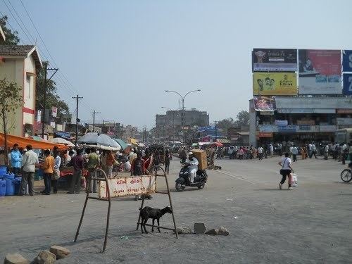
The main town of Fort Songadh is located on Highway 6 with Nandurbar district to its east and Vyara (district headquarters) to its west. Surat is about 85 km from Songadh which has a higher population and substantially more industry. Surat has grown faster than other cities of Gujarat and consequently Tapi district was created from the former District of Surat and Vyara was selected as the capital of the Tapi district. Songadh is about 259 km from Vadodara,about 85 km from Surat,about 18 km from Vyara.
The main town of Songadh is split into two parts; Junagam (old town) and Navagam (new town). Due to rapid expansion of the town in recent times, Navagam has outgrown the original Junagam and is characterised by the hustle and bustle of the Main Road almost any time of the day. This is largely due to the Bus Terminal which acts as a hub for cross country buses which are en route to the city of Surat. This passing traffic has bought much trade into Songadh as it is the first town as you enter Gujarat from the East (or the last before you leave from the West).
To the west of Songadh is the district capital of Vyara which has a slightly smaller population but substantially more industry. Vyara has grown faster than Songadh due to the higher work ethic of the Vyara population in comparison to the younger population of Songadh, this is in part due to the practice of intermarrying of cousins in Songadh.
Places of interest in Fort Songadh
The Fort of Songadh literraly means 'Son' stands for Gold & 'Gadh' stands for fort which means that the 'Fort of Gold'
History of Fort
The Songadh Fort was built by the founder of the Gaekwad dynasty, Pillaji Rao Gaekwad between 1729-1766. Built deliberately on top of the high hill as a vantage point to keep an eye on enemies, the fort is also a brilliant example of Indian architecture where the influence of both Mughals and Marathas are evident. There are not many forts built in Gujarat State due to the relatively flat nature of the landscape. Neighbouring Maharashtra has comparatively many forts because of its topology. Maharashtra is guarded by Sahyadri Mountains. So the forts are in Maharashtra are very difficult to trek where as the fort in Songadh does not have much height and its takes approximately half an hour to reach the top of the fort.
Neighbouring Towns
Demographics
As of 2001 India census, Songadh had a population of 22,426. Males constitute 51% of the population and females 49%. Songadh has an average literacy rate of 65%, higher than the national average of 59.5%: male literacy is 72%, and female literacy is 58%. In Songadh, 14% of the population is under 6 years of age.
Health Facilities in Songadh is predominantly provided by 1) Community Health Centre ( Referral Hospital), 2) Sarthak Hospital (a Physician speciality advanced care hospital), 3) Dhiraj Hospital(a Surgical hospital), 4) Mamta Hospital, 5) Sanjeevani Hospital(paediatric), 6)Sai Krupa Hospital(Gynaec), 7) Kumar Hospital, and a number of General Practitioners.
Villages of Songadh Taluka
Demographics
As of 2001 India census, Songadh had a population of 22,426. Males constitute 51% of the population and females 49%. Songadh has an average literacy rate of 65%, higher than the national average of 59.5%: male literacy is 72%, and female literacy is 58%. In Songadh, 14% of the population is under 6 years of age.