
Mission type Environmental COSPAR ID 2015-003A Website smap.jpl.nasa.gov Launch date 31 January 2015 Inclination 98.12° Mission duration 3 years | SATCAT no. 40376 Inclination 98.12° Period 1.6 hours Launch site Vandenberg Air Force Base | |
 | ||
Similar Soil Moisture and Ocea, Aquarius, Orbiting Carbon Observatory, Aqua, ICESat | ||
Smap at work nasa s soil moisture active passive satellite
Soil Moisture Active Passive (SMAP) is an American environmental research satellite launched on 31 January 2015. It was one of the first Earth observation satellites developed by NASA in response to the National Research Council’s Decadal Survey.
Contents
- Smap at work nasa s soil moisture active passive satellite
- Smap s global impact nasa s soil moisture active passive satellite
- Mission overview
- Measurement concept
- Scientific payload
- Program description
- Science and applications
- Weather and climate forecasting
- Drought
- Floods and landslides
- Agricultural productivity
- Human health
- Status
- References
Smap s global impact nasa s soil moisture active passive satellite
Mission overview
SMAP will provide measurements of the land surface soil moisture and freeze-thaw state with near-global revisit coverage in 2–3 days. SMAP surface measurements will be coupled with hydrologic models to infer soil moisture conditions in the root zone. These measurements will enable science applications users to:
- Understand processes that link the terrestrial water, energy, and carbon cycles.
- Estimate global water and energy fluxes at the land surface.
- Quantify net carbon flux in boreal landscapes.
- Enhance weather and climate forecast skill.
- Develop improved flood prediction and drought monitoring capability.
SMAP observations will be acquired for a period of at least three years after launch. A comprehensive validation, science, and applications program will be implemented, and all data will be made available publicly through the NASA archive centers.
Measurement concept
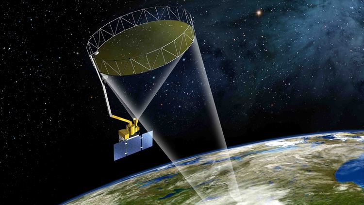
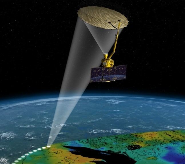
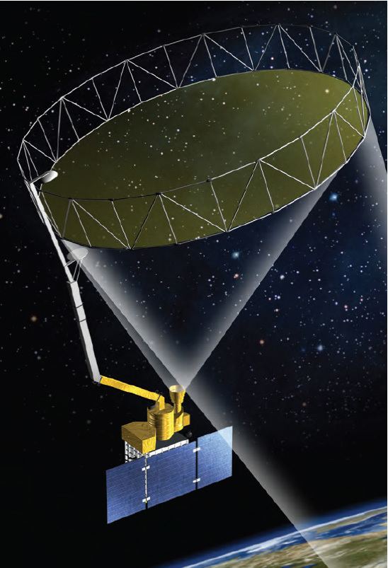
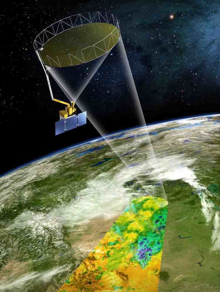
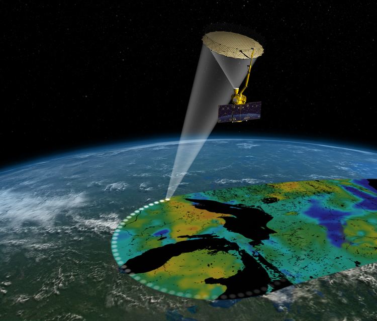
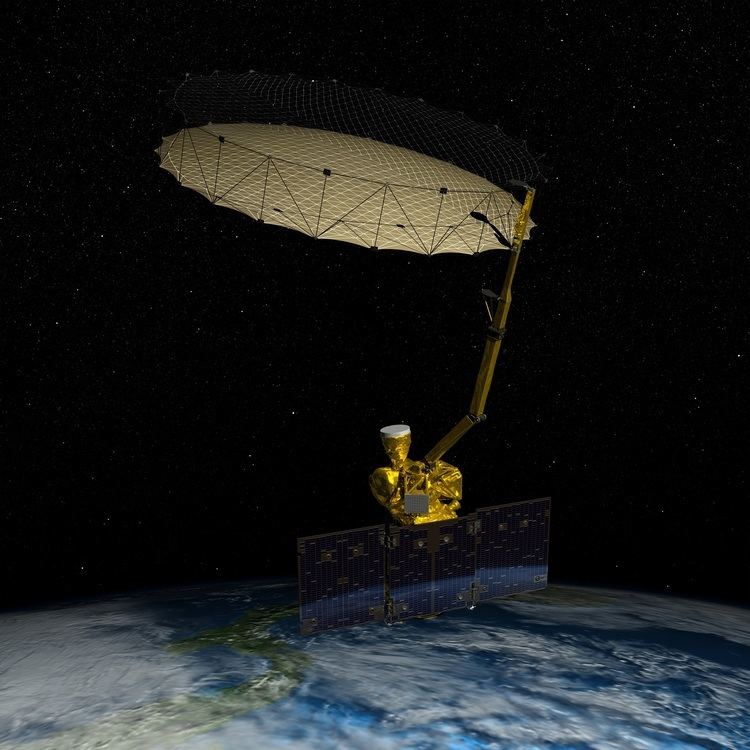
The SMAP observatory includes a dedicated spacecraft and instrument suite in a near-polar, Sun-synchronous orbit. The SMAP measurement system consists of a radiometer (passive) instrument and a synthetic aperture radar (active) instrument operating with multiple polarizations in the L-band range. The combined active and passive measurement approach takes advantage of the spatial resolution of the radar and the sensing accuracy of the radiometer.
The active and passive sensors provide coincident measurements of the surface emission and backscatter. The instruments sense conditions in the top 5 cm of soil through moderate vegetation cover to yield globally mapped estimates of soil moisture and its freeze-thaw state.
Scientific payload
The satellite carries two scientific instruments: a radar and a radiometer, that share a single feed and deployable 6m reflector antenna system that rotates around the nadir axis making conical scans of the surface. The wide swath provides near-global revisit every 2–3 days.
Program description
SMAP is a directed mission of the National Aeronautics and Space Administration NASA. The SMAP project is managed for NASA by the Jet Propulsion Laboratory JPL, with participation by the Goddard Space Flight Center GSFC. SMAP builds on the heritage and risk reduction activities of NASA's cancelled ESSP Hydros Mission.
Science and applications
SMAP observations will be used to characterize hydrologic and ecosystem processes including land-atmosphere exchanges of water, energy, and carbon. Among the users of SMAP data will be hydrologists, weather forecasters, climate scientists and agricultural and water resource managers. Additional users include fire hazard and flood disaster managers, disease control and prevention managers, emergency planners and policy makers. SMAP soil moisture and freeze-thaw information will directly benefit several societal applications areas, including:
Weather and climate forecasting
Initialization of numerical weather prediction models and seasonal climate models with accurate soil moisture information will extend forecast lead times and enhance prediction skill.
Drought
SMAP soil moisture information will improve the monitoring and forecasting of drought conditions, enabling new capabilities for mitigating drought impacts.
Floods and landslides
Hydrologic forecast systems calibrated and initialized with high-resolution soil moisture fields will lead to improved flood forecasts and will provide essential information on the potential for landslides.
Agricultural productivity
Soil moisture observations from SMAP will lead to improvements in crop yield forecasts and will enhance the capabilities of crop water stress decision support systems for agricultural productivity.
Human health
Improved seasonal soil moisture forecasts will directly benefit famine early warning systems. Benefits will also be realized through improved predictions of heat stress and virus spread rates, and improved disaster preparation and response.
Status
In August 2015, scientists completed their initial calibration of the two instruments on board, however, SMAP's radar stopped transmitting July 7 due to an anomaly that was investigated by a team at JPL. The team identified the anomaly to the power supply for the radar's high-power amplifier. On 2 September 2015, NASA announced that the amplifier failure meant that the radar could no longer return data. The science mission continues with data being returned only by the radiometer instrument.