
Region Kantō Phone number 0438-62-2111 Local time Sunday 12:51 AM | Population 60,995 (1 Dec 2015) | |
 | ||
Website www.city.sodegaura.chiba.jp Weather 6°C, Wind NE at 26 km/h, 77% Humidity Points of interest Country Farm Tokyo Ge, sodegaura Seaside Park, Sodegaura Park, Domeki Park, Fukuodai Central Park | ||
Sodegaura (袖ヶ浦市, Sodegaura-shi) is a city located in the west-center Bōsō Peninsula of Chiba Prefecture, Japan, bordered by Tokyo Bay to the west.
Contents
- Map of Sodegaura Chiba Prefecture Japan
- Surrounding municipalities
- History
- Economy
- Education
- Railway
- Highway
- Sister city relations
- Notable people from Sodegaura
- References
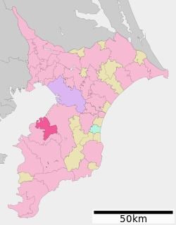
Map of Sodegaura, Chiba Prefecture, Japan
As of December 1, 2015, the city had an estimated population of 60,995 and a population density of 643 persons per km2. The total area was 94.92 square kilometres (36.65 sq mi).
Surrounding municipalities
Chiba Prefecture
History
Sodegaura is mentioned in the Nara period chronicle Kojiki in connection with the Yamatotakeru mythology, and at that time applied to the entire western coastline of the Boso Peninsula. Modern Sodegaura was part of Kimitsu District from the Meiji period. Sodegaura Town was formed on March 31, 1955 from the merger of the town of Shōwa with the neighboring village of Nagaura and a portion of the village of Negata. It expanded through merger with the town of Hirakawa on November 3, 1971. On April 1, 1991 it was elevated to city status.
Economy
Sodegaura is an important part of the Keiyō Industrial Zone. The industrial Port of Chiba ranges from Funabashi in the north to Sodegaura in the south. Heavy industry, especially oil refineries and chemical processing, is located on reclaimed land in the city.
Education
Sodegaura has eight elementary schools, five middle schools and one high school, as well as one special education school.