
Population 519 (2013 est) Founded 1920 | Established 1920 Area 1,595 km² Mayor Susan Bruse | |
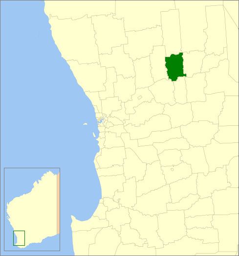 | ||
The Shire of Wyalkatchem is a local government area located in the Wheatbelt region of Western Australia. Its seat of government is the town of Wyalkatchem, about 190 kilometres (118 mi) northeast of Perth, the state capital.
Contents
Map of Wyalkatchem, WA, Australia
History
On 18 June 1920, the Wyalkatchem Road District was created out of land previously administered by the Ninghan and Dowerin Road Boards. On 1 July 1961, it became the Shire of Wyalkatchem under the Local Government Act 1960.
Wards
The shire has no wards, and seven councillors. The shire president is elected from amongst the councillors.
Towns and localities
References
Shire of Wyalkatchem Wikipedia(Text) CC BY-SA