
President Jorgen Jensen Area 13,692 km² | State electorate(s) North West Population 458 (2006) | |
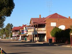 | ||
The Shire of Mount Magnet is a local government area in the Mid West region of Western Australia, about 570 kilometres (354 mi) north-northeast of the state capital, Perth. The Shire covers an area of 13,692 square kilometres (5,287 sq mi), and its seat of government is the town of Mount Magnet.
Contents
Map of Mount Magnet, WA 6638, Australia
History
Mount Magnet was gazetted as a municipality in 1896, with the surrounding area gazetted as a road board in 1901. The former merged into the latter in October 1918, and on 1 July 1961, it became a shire following changes to the Local Government Act.
Wards
As of the 2005 elections, the Shire is no longer divided into wards and the nine councillors sit at large. Previously, there were two wards - Town Ward (six councillors) and Country Ward (three councillors).