
Population 976 (2013 est) Founded 1895 Mayor John Bird | Established 1895 Area 1,837 km² | |
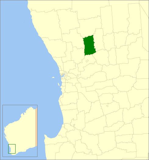 | ||
The Shire of Goomalling is a local government area in the Wheatbelt region of Western Australia, about 240 kilometres (149 mi) northeast of Perth, the state capital. The Shire covers an area of 2,836 square kilometres (1,095 sq mi) and its seat of government is the town of Goomalling.
Contents
History
On 18 January 1895, the Goomalling Road District was created. On 1 July 1961, it became a Shire following the enactment of the Local Government Act 1960.
Wards
The shire has been divided into 4 wards:
Towns and localities
References
Shire of Goomalling Wikipedia(Text) CC BY-SA