
Population 40,000 (1992) Area 324 km² | Established 1858 Shire of Flinders Hastings Founded 1858 | |
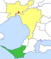 | ||
The Shire of Flinders was a local government area, encompassing the extremity of the Mornington Peninsula, about 65 kilometres (40 mi) south of Melbourne, the state capital of Victoria, Australia. The shire covered an area of 324 square kilometres (125.1 sq mi), and existed from 1874 until 1994.
Contents
History
The Kangerong Road District (adjoining Port Phillip) was created on 14 October 1862. The Flinders Road District, on the east of the peninsula, was created on 15 December 1868. They united to become the Shire of Flinders & Kangerong on 24 December 1874, which was renamed Flinders on 28 January 1914. On 19 October 1960, part of the Eastern Riding was transferred to the new Shire of Hastings, which had split from the Shire of Frankston.
On 15 December 1994, the Shire of Flinders was abolished, and, along with the Shires of Hastings and Shire of Mornington and parts of the City of Frankston, was merged into the newly created Shire of Mornington Peninsula. The Age reported in July 1994 that the result had been supported by Hastings and Mornington councils from the beginning, but opposed by Flinders, which wanted to merge with the southern coastal section of Hastings.
Council formerly met at the Shire Offices, on Boneo Road, Rosebud. The facility is still used today by the Shire of Mornington Peninsula.
Wards
The Shire of Flinders was divided into four ridings in May 1961, each of which elected three councillors:
Suburbs and localities
Population
* Estimate in the 1958 Victorian Year Book.
+ Drop in population due to loss of part of eastern riding to the new Shire of Hastings in 1960.