
Population 2,696 (2011) Area 3.6 km² | Postcode(s) 3941 Postal code 3941 | |
 | ||
Location 81 km (50 mi) from Melbourne7 km (4 mi) from Rosebud LGA(s) Shire of Mornington Peninsula | ||
Tootgarook is located approximately 81 km from Melbourne, Victoria, Australia. Its local government area is the Shire of Mornington Peninsula.
Contents
Map of Tootgarook VIC 3941, Australia
History
The name Tootgarook was retained by J. Purves as the name of their pre-emptive right, and was taken from the Tootgarook swamp, the town is named from J. Purves pastoral run established adjacent to the west of the swamp. A Tootgarook Post Office opened in 1858 and was renamed Rye in 1870. A later Tootgarook Post Office opened on 3 April 1956 when some development took place in the suburb, and closed in 1987 Tootgarook means "Land of the Croaking Frog".
Today
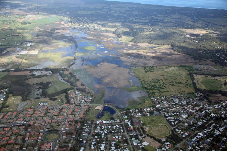
In the same suburb, but extending to neighbouring suburbs, is the Tootgarook Wetland. This wetland is about 300 hectares in size and supports many rare and endangered species of flora and fauna. Most of the wetland is in private ownership and some is vulnerable to development.
The local school in the area is Tootgarook Primary School, which currently has 203 students.