
Population 1,295 (2013 est) Founded 1916 Mayor Robert Nixon | Established 1916 Area 7,236 km² | |
 | ||
The Shire of Dalwallinu is a local government area in the Wheatbelt region of Western Australia, about 250 kilometres (155 mi) NNE of Perth, the state capital. The Shire covers an area of 7,236 square kilometres (2,794 sq mi) and its seat of government is the town of Dalwallinu.
Contents
History
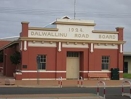
Initially, the area was part of the Moora and Upper Irwin Road Districts. On 2 June 1916, the Dalwallinu Road District was created. On 1 July 1961, it became a shire following the enactment of the Local Government Act 1960.
Wards
On 14 May 1966, the Shire was divided into four wards: Central, North, South and East Wards, and membership was increased from 9 to 11. On 22 May 1971, a new ward, Dalwallinu Townsite Ward with one councillor, was created and the council reduced back to 9 councillors by allocating 2 each to the original four wards. In 1992, the Central and Dalwallinu Townsite Wards were merged to form the new Central Ward, and on 3 May 2003, the Central and South Wards were merged to form the new South Ward.
As such, the present ward system of the shire is: