
Population 4,560 (1992) Area 702.3 km² | Established 1862 Founded 1862 | |
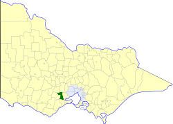 | ||
The Shire of Bannockburn was a local government area about 85 kilometres (53 mi) west-southwest of Melbourne, the state capital of Victoria, Australia. The shire covered an area of 702.28 square kilometres (271.2 sq mi), and existed from 1862 until 1994.
Contents
History
Bannockburn was first incorporated as a road district on 31 October 1862, and became a shire on 30 June 1864. On 15 September 1915, it annexed the Shire of Meredith, which had been created on 30 June 1863, and became a shire on 28 April 1871. Parts of the shire's Steiglitz Riding were severed and annexed to the Shire of Corio's Lara Riding on 31 May 1916.
On 6 May 1994, the Shire of Bannockburn was abolished, and, along with the Shires of Grenville and Leigh, and parts of the Shire of Buninyong, was merged into the newly created Golden Plains Shire.
Wards
The Shire of Bannockburn was divided into four ridings, each of which elected three councillors:
Towns and localities
Population
* Estimate in 1958 Victorian Year Book.