
Length 31,300 m Construction started 1817 | Province Québec Major cities Montreal | |
 | ||
Location Between Avenue Westminster and Gouin Boulevard | ||
Sherbrooke Street (officially in French: rue Sherbrooke) is a major east-west artery and at 31.3 kilometres (19.4 mi) in length, is the second longest street on the Island of Montreal. The street begins in the town of Montreal West and ends on the extreme tip of the island in Pointe-aux-Trembles, intersecting Gouin Boulevard and joining up with Notre-Dame Street. East of Cavendish Boulevard this road is part of Quebec Route 138.
Contents
Map of Sherbrooke St E, Montreal, QC, Canada
The street is divided into two portions. Sherbrooke Street East is located east of Saint Laurent Boulevard and Sherbrooke Street West is located west. Sherbrooke Street West is home to many historic mansions that comprised its exclusive Golden Square Mile district, including the now-demolished Van Horne Mansion, the imposing Beaux-Arts style Montreal Masonic Memorial Temple as well as several historic properties incorporated into Maison Alcan, the world headquarters for Alcan.
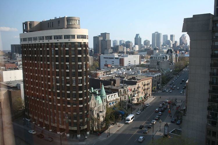
Sherbrooke Street East runs along the edge (both administrative and topographic) of the Plateau Mont-Royal, at the top of a marked hillside known as Côte à Baron, and continues between the Jardin Botanique de Montréal and Parc Maisonneuve to the north and Parc Olympique to the south. The street is named for John Coape Sherbrooke, the Governor General of British North America from 1816-18.
History
In 1817, Sherbrooke Street initially consisted of two sections, from de Bleury Street to Sanguinet Street. Its relative remoteness from downtown at the time made it difficult to establish industries or factories. Many nursing homes and educational institutions were established on the street in the nineteenth century, such as McGill University, the école normale Jacques-Cartier, the Collège Mont-Saint-Louis and the Couvent du Bon Pasteur.
From the early twentieth century until the 1930s, Sherbrooke Street was the most prestigious street in Montreal. In 1912, the Montreal Museum of Fine Arts was established on Sherbrooke Street West. Later with the expansion of the city center, luxurious new houses were built a little further west in the new Garden City of Westmount.
Sherbrooke Street was prolonged eastward starting in the early twentieth century, and followed the urban development of Montreal eastward. It was central to the creation of several institutions and parks such as La Fontaine Park, the Notre-Dame Hospital, Maisonneuve Park, Montreal Botanical Garden and Olympic Stadium.
In 1976, the street was to be venue for an eight-kilometre exhibit of art entitled Corridart during the 1976 Summer Olympics. However, in a controversial decision, former Mayor Jean Drapeau had the exhibition torn down two days before the Games began.
Educational institutions
Three of Montreal's four major universities are present on Sherbrooke. Downtown, the street is home to the main campus of McGill University; further west, the Loyola Campus of Concordia University. Sherbrooke is also home to UQAM's Complexe des sciences Pierre-Dansereau, and INRS's Montréal campus as well as Dawson College, Collège de Maisonneuve CEGEPs, and the Collège de Montréal.
Attractions
Other key attractions on the street include the Montreal Museum of Fine Arts, McCord Museum, Ritz-Carlton Montreal, Holt Renfrew, Parc Lafontaine, and further east, the Château Dufresne, Olympic Stadium, Montreal Botanical Garden and the Montreal Biodome.