
Location Saint Lawrence River Highest elevation 233 m (764 ft) Area 499.2 km² Elevation 233 m Province Québec | Width 16 km (9.9 mi) Population 1,886,481 (2011) Max length 50 km | |
 | ||
Points of interest | ||
The Island of Montreal (French: Île de Montréal, Kanien’kéha: Tiohtià:ke), in southwestern Quebec, Canada, is located at the confluence of the Saint Lawrence and Ottawa rivers. It is separated from Île Jésus (Laval) by the Rivière des Prairies.
Contents
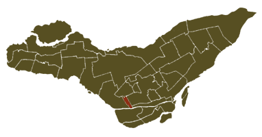
Map of Island of Montreal, Qu%C3%A9bec, Canada
The island is boomerang-shaped (one end pointing roughly west, the other roughly northeast). It is the largest island in the Hochelaga Archipelago, and the second largest in the Saint Lawrence River (following Anticosti Island in the Gulf of Saint Lawrence). It is the most populous island in Canada and the 37th most populous island on earth. Montreal Island is the second most populous river island in the world (behind Zhongshan Dao in China), as well as the most populous of any island in the world on fresh water.
The St. Lawrence widens into Lake Saint-Louis south-west of the island, narrows into the Lachine Rapids, then widens again into the Bassin de La Prairie before becoming the St. Lawrence again and flowing toward Quebec City. Saint Helen's Island and Notre Dame Island are in the Saint Lawrence southeast of downtown Montreal.
The Ottawa widens and becomes Lac des Deux-Montagnes north-west of the island. The Sainte-Anne-de-Bellevue Canal, between the western tip of the island and Île Perrot, connects Lac des Deux-Montagnes and Lake Saint-Louis. Another outlet of Lac des Deux-Montagnes, the Rivière des Prairies, flows along the north shore of the island and into the St. Lawrence at the northeastern tip of the island.
The island is approximately 50 km long and 16 km wide at its widest point. The area of the census division and administrative region of Montréal, which includes the Island of Montreal, Nuns' Island (Île des Sœurs), Île Bizard, Île Sainte-Hélène, Notre Dame Island, Île Dorval, and several other smaller islands, is 499 km². The island of Montreal has a shoreline of 266 km. At its centre are the three peaks of Mount Royal. The southwest of the island is separated by the Lachine Canal between Lachine and Montreal's Old Port; this portion of the island is partially divided further by the Canal de l'Aqueduc, running roughly parallel to the Lachine Canal, beginning in the borough of LaSalle and continuing between the boroughs of Le Sud-Ouest and Verdun.
The island of Montreal is the major component of the territory of the city of Montreal, along with Île Bizard, Saint Helen's Island, Notre Dame Island, Nuns' Island, and some 69 smaller islands. With a population of 1,861,900 inhabitants (22% of the population of Quebec), it is by far the most populous island in Canada. It is also the 6th most populous island of the Americas and the 37th most populated island on earth, outranking Manhattan Island in New York City. Montreal and the other municipalities on the island compose the administrative region of Montréal.
The crossings which connect the island to its surroundings are some of the busiest bridges in the country and the world. The Champlain Bridge and the Jacques Cartier Bridge together accommodate 101 million vehicles a year.
Name
The first French name for the island was "l'ille de Vilmenon", noted by Samuel de Champlain in a 1616 map, and derived from the sieur de Vilmenon, a patron of the founders of Quebec at the court of Louis XIII. However, by 1632 Champlain referred to the "Isle de Mont-real" in another map. The island derived its name from Mount Royal (French Mont Royal, then pronounced [mɔ̃ʁwɛjal]), and gradually spread its name to the town, which had originally been called Ville-Marie.
In the Kanien’kéha, the island is called Tiohtià:ke Tsi (a name referring to the Lachine Rapids to the island's southwest) or Ka-wé-no-te. In Anishninaabemowin, the land is called Mooniyaang (a name meaning "the first stopping place" and part of the seven fires prophecy).