
 | ||
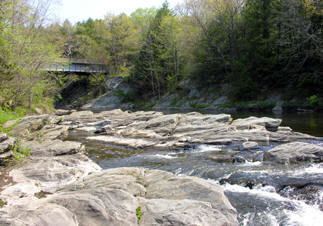
The Shepaug River is a 26.0-mile-long (41.8 km) river in Connecticut, in the United States.
Contents
Map of Shepaug River, Connecticut, USA
The river originates in Warren and runs south through Washington, Roxbury, and Southbury, where it joins the Housatonic River at Lake Lillinonah (41.5102°N 73.3190°W / 41.5102; -73.3190) dammed by the hydroelectric Shepaug Dam, thereafter flowing into the Long Island Sound. The river's watershed area comprises approximately 150 square miles (390 km2), which encompasses the towns of Cornwall, Goshen, Torrington, Warren, Litchfield, Washington, Morris, New Milford, Roxbury, Bridgewater, and Southbury.
The vicinity of the Shepaug River has been inhabited by humans since around 4000 B.C., though according to archaeology, there was a decline in population around 1000 B.C.
The river is a primary source of drinking water for the city of Waterbury, and has been the subject of regional litigation over how much water may be removed from the river.