
NECTA None Incorporated 1719 Elevation 151 m Population 1,232 (2013) | Time zone Eastern (UTC-5) Local time Thursday 11:53 PM | |
 | ||
Weather -3°C, Wind S at 3 km/h, 44% Humidity | ||
Litchfield connecticut
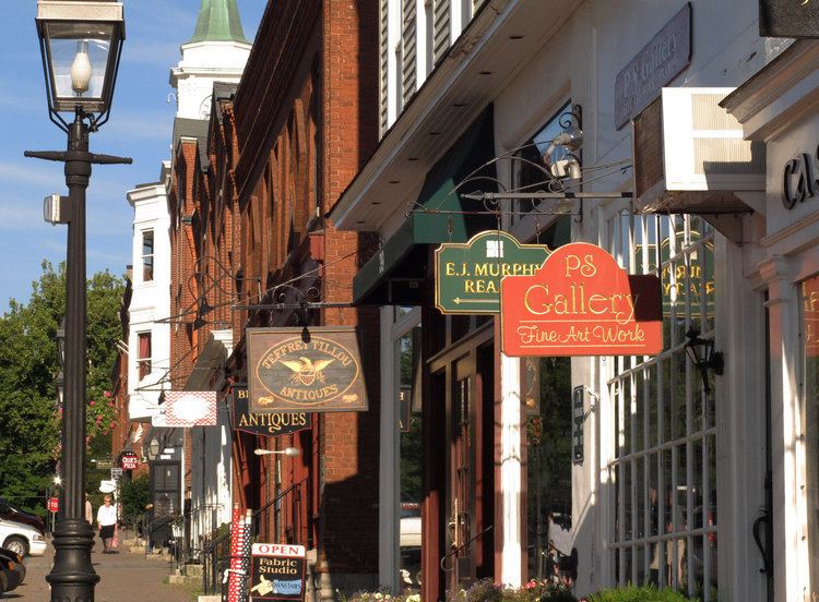
Litchfield is a town in and former county seat of Litchfield County, Connecticut, United States. The population was 8,466 at the 2010 census. The boroughs of Bantam and Litchfield are located within the town. There are also three unincorporated villages: East Litchfield, Milton, and Northfield.
Contents
- Litchfield connecticut
- Map of Litchfield CT USA
- Geography
- Principal communities
- Demographics
- Transportation
- Notable people
- On the National Register of Historic Places
- References
Map of Litchfield, CT, USA
Geography
Located southwest of Torrington, Litchfield also includes part of Bantam Lake. According to the United States Census Bureau, the town has a total area of 56.8 square miles (147.1 km²), of which, 56.1 square miles (145.2 km²) of it is land and 0.7 square miles (1.9 km²) of it (1.3%) is water.
Litchfield is about 95 mi (153 km) from Central Park in New York, about 50 mi (80 km) from the Hudson River valley, and about 40 mi (64 km) from the nearest sea coast, on Long Island Sound.
Principal communities
Demographics
As of the census of 2000, there were 8,316 people, 3,310 households, and 2,303 families residing in the town. The population density was 148.4 people per square mile (57.3/km²). There were 3,629 housing units at an average density of 64.7 per square mile (25.0/km²). The racial makeup of the town was 96.99% White, 0.75% Black or African American, 0.23% Native American, 0.47% Asian, 0.01% Pacific Islander, 0.46% from other races, and 1.09% from two or more races. Hispanic or Latino of any race were 1.56% of the population.
There were 3,310 households out of which 31.2% had children under the age of 18 living with them, 59.9% were married couples living together, 7.2% had a female householder with no husband present, and 30.4% were non-families. 26.5% of all households were made up of individuals and 13.2% had someone living alone who was 65 years of age or older. The average household size was 2.45 and the average family size was 2.98.
In the town, the population was spread out with 25.2% under the age of 18, 3.6% from 18 to 24, 25.6% from 25 to 44, 28.6% from 45 to 64, and 17.0% who were 65 years of age or older. The median age was 43 years. For every 100 females there were 92.5 males. For every 100 females age 18 and over, there were 90.3 males.
The median income for a household in the town was $58,418, and the median income for a family was $70,594. Males had a median income of $50,284 versus $31,787 for females. The per capita income for the town was $30,096. About 2.8% of families and 4.0% of the population were below the poverty line, including 2.6% of those under age 18 and 5.2% of those age 65 or over.
Transportation
Route 202 is the main east-west road connecting Bantam and Litchfield center to the city of Torrington. Route 63 runs north-south through the town center. The Route 8 expressway runs along the town line with Harwinton. It can be accessed from the town center via Route 118. The town is also served by buses from the Northwestern Connecticut Transit District connecting to the city of Torrington. The Shepaug Valley Railroad opened a Litchfield terminal in 1872, but passenger service ended in 1930 and freight service in 1948.