
Width 330 km (210 mi) E/W Elevation 2,673 m | Length 560 km (350 mi) N/S Parent range Indo-Malayan System | |
 | ||
Mountains | ||
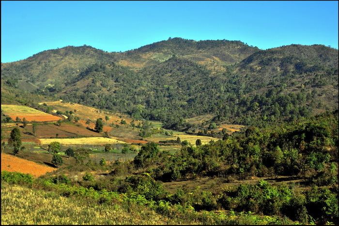
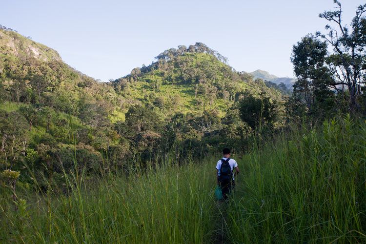
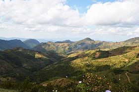
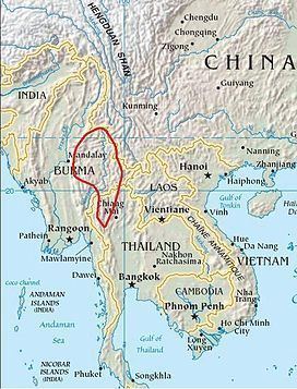
The Shan Hills (Burmese: ရှမ်းရိုးမ, Thai: ฉานโยมา; Shan Yoma), also known as Shan Highland, is a vast mountainous zone that extends through Yunnan to Myanmar and Thailand. The whole region is made up of numerous mountain ranges separated mostly by narrow valleys as well as a few broader intermontane basins. The ranges in the area are aligned in such a way that they link to the foothills of the Himalayas further to the northwest.
Contents

The highest point is Loi Leng, at 2,673 m high. Other peaks are 2,565 m Mong Ling Shan, 2,565 m Doi Inthanon and 2,563 m Loi Pangnao. All are ultra prominent peaks of Southeast Asia.
Etymology
The name of the massif or system of ranges, is derived from the Shan State and its peoples, said in its turn to be derived from the word "Siam", that occupies most of the Shan Highland area.
Since it was relatively unexplored until recent times, the Shan mountainous region was referred to as the "Shan Plateau" in geographic works of the British colonial period, a name that is still sometimes used. However, since the whole area lacks the expanses of relatively flat high terrain which are the main characteristic of a plateau, this label is rather incongruous.
Geology
Geologically in the Shan Hills and their southern subranges, layers of alluvium are superimposed on hard rock. Karstic ranges are common, for large tracts of the hills are limestone. The Shan Hills are an important silver and ruby mining area.
Geography
The area of the Shan Highland is a combination of hill ranges, steep river valleys and a few elevated plains, also known as the Shan Plateau. The area is the primary source of Myanmar's sapphires, rubies and other gems, for which the country is famous; it is also a principal source of lead, silver and zinc. The high plain averages about 1,000 metres (3,300 ft) in elevation, and is sparsely populated.
The Shan Hills straddle central eastern Myanmar and northwestern Thailand. They rise steeply from Myanmar's central plain and stretch for hundreds of kilometres eastwards into Thailand's northwest. The average elevation is around 1,000 m. The surface of the system is cut across by steep river gorges, part of the drainage basins of the Chao Phraya, the Irrawaddy, the Sittaung and the Salween or Thanlwin River which cuts across the plateau in a north/south direction.
Subranges
History
In British colonial times, the main hill station in Burma, Pyin Oo Lwin known in English as Maymyo, was built in the western region of the Shan Hills. At 1,000 m above sea level and about one-hour drive from Mandalay, it was one of the retreats for colonial officials escaping the heat of the Burmese summer. Pyin Oo Lwin is still known for its botanical gardens and, like all British hill stations, has samples of colonial architecture. Presently Inle Lake near Yawnghwe is one of the tourist attractions of the Shan highlands.
The Taunggyi Bird Sanctuary, established in 1906 as the Taunggyi Wildlife Reserve was redesignated as a bird sanctuary in 1989.
Owing to the insurgency and the activity of the Tatmadaw in the area many local people living in the mountainous areas of the Shan Hills moved across the border to Thailand where they live in refugee camps.
Despite the ongoing insurgency, the Shan Hills is the area of Burma which accounts for most of the national potato production.
On 24 March 2011 a magnitude 6.8 earthquake struck in Tarlay, Tachileik Township, in the Daen Lao range area on the eastern part of the hill system. It killed more than 70 and injured more than 100 people. Three hundred-ninety houses, 14 Buddhist monasteries and nine government buildings were damaged.