Puneet Varma (Editor)

Sentinel 3

Updated on
Edit
Like
Comment
Share on FacebookTweet on TwitterShare on LinkedInShare on Reddit
Manufacturer
  
Thales Alenia Space

Applications
  
Earth observation

Bus
  
Prima

Operator
  
EUMETSAT

Spacecraft type
  
Satellite

Constellation
  
3

Sentinel-3 httpssentinelesaintimageimagegalleryimgi

Sentinel 3 technology and heritage


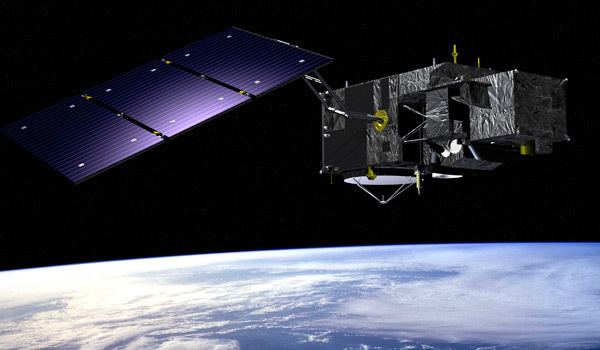
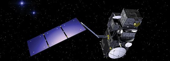
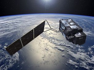
Sentinel-3 is an Earth observation satellite constellation developed by the European Space Agency as part of the Copernicus Programme.

Contents

Sentinel-3 RAL Space Sentinel3

Copernicus, formerly Global Monitoring for Environment and Security, is the European programme to establish a European capacity for Earth observation designed to provide European policy makers and public authorities with accurate and timely information to better manage the environment, and to understand and mitigate the effects of climate change.

Sentinel-3 Sentinel3 Instrument Payload Sentinel Online

Sentinel 3 for oceans


Overview

Sentinel-3 Third Sentinel satellite launched for Copernicus Sentinel3

On 14 April 2008, the European Space Agency and Thales Alenia Space signed a €305 million contract to build the first GMES Sentinel-3 in its Cannes Mandelieu Space Center. Satellite platform was delivered to France for final components assembly in 2013. Communications systems were completed by Thales Alenia Space España in early 2014.

Sentinel-3 Sentinel3 Copernicus

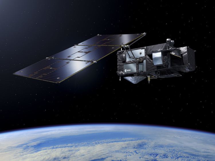
The Sentinel-3 mission's main objective is to measure sea-surface topography, sea- and land-surface temperature and ocean- and land-surface colour with accuracy in support of ocean forecasting systems, and for environmental and climate monitoring. Sentinel-3 builds directly on the heritage pioneered by ERS-2 and Envisat satellites. Near-real time data will be provided for ocean forecasting, sea-ice charting, and maritime safety services on the state of the ocean surface, including surface temperature, marine ecosystems, water quality and pollution monitoring.

Sentinel-3 Sentinel3 Orbit Design Copernicus

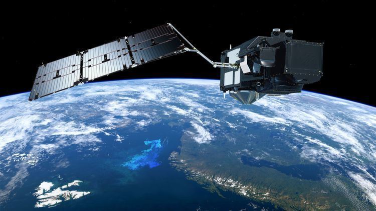
A pair of Sentinel-3 satellites will enable a short revisit time of less than two days for OLCI instrument and less than one day for SLSTR at the equator. The satellite orbit provides a 27-day repeat for the topography package, with a 4-day sub-cycle.

Objectives

Mission objectives are:

Sentinel-3 726 Sentinel3 Radar Altimetry Tutorial and Toolbox

  • Measure sea-surface topography, sea-surface height and significant wave height
  • Measure ocean and land-surface temperature
  • Measure ocean and land-surface colour
  • Monitor sea and land ice topography
  • Sea-water quality and pollution monitoring
  • Inland water monitoring, including rivers and lakes
  • Aid marine weather forecasting with acquired data
  • Climate monitoring and modelling
  • Land-use change monitoring
  • Forest cover mapping
  • Fire detection
  • Weather forecasting
  • Measuring Earth's thermal radiation for atmospheric applications
  • Mission characteristics
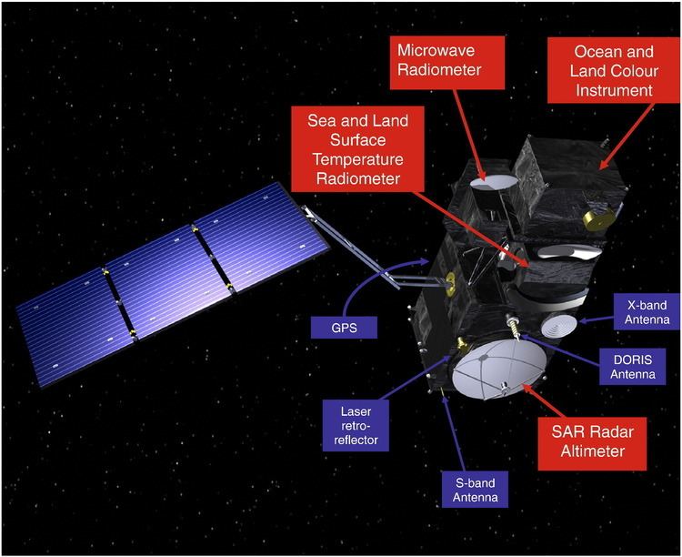
  • Role: Earth observation satellite
  • Launch mass: Appx. 1,250 kg (2,760 lb)
  • Orbit: Sun-synchronous
  • Altitude: 814 km (506 mi)
  • Inclination: 98.6°
  • Local time of Descending Node: 10:00 a.m.
  • Orbit cycle: ~100 minutes
  • Nominal duration: 7.5 years
  • Instruments

    Sentinel-3 will make use of multiple sensing instruments:

  • SLSTR (Sea and Land Surface Temperature Radiometer) will determine global sea-surface temperatures to an accuracy of better than 0.3 K (0.3 °C; 0.5 °F). It measures in nine spectral channels and two additional bands optimised for fire monitoring.
  • OLCI (Ocean and Land Colour Instrument) is a medium-resolution imaging spectrometer that uses five cameras to provide a wide field of view. SLSTR and OLCI are optical instruments with an overlap of their swath path, allowing for new combined applications.
  • SRAL (SAR Altimeter) is the main topographic instrument to provide accurate topography measurements over sea ice, ice sheets, rivers and lakes. It uses dual-frequency Ku and C band and is supported by a microwave radiometer for atmospheric correction and a DORIS receiver for orbit positioning.
  • DORIS (Doppler Orbitography and Radiopositioning Integrated by Satellite) is a receiver for orbit positioning.
  • MWR (Microwave Radiometer) will measure water vapour and cloud water content and the thermal radiation emitted by the Earth.
  • LRR (Laser Retroreflector) will be used to accurately locate the satellite in orbit using a laser ranging system. When used in combination with SRAL, DORIS, MWR, they will acquire detailed topographic measurements of the ocean and in-land water.
  • GNSS (Global Navigation Satellite System) will provide precise orbit determination and can track multiple satellites simultaneously.
  • Applications

    The observations acquired by the mission will be used to in conjunction with other ocean-observing missions to contribute to the Global Ocean Observing System (GOOS) which aims to create a permanent system of ocean observation.

  • Ocean colour and land reflectance data
  • Sea, land and ice surface temperature
  • Active fire and burnt area monitoring
  • Sea surface topography data
  • References

    Sentinel-3 Wikipedia