
 | ||
Satellite imagery consists of images of Earth or other planets collected by satellites. Imaging satellites are operated by governments and businesses around the world. Satellite imaging companies sell images under licence. Images are licensed to governments and businesses such as Apple Maps and Google Maps.
Contents
History
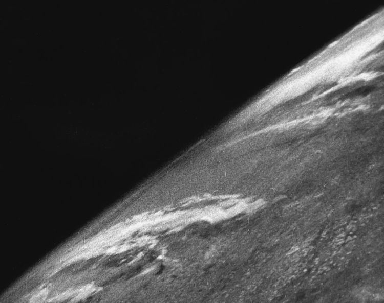
The first images from space were taken on sub-orbital flights. The U.S-launched V-2 flight on October 24, 1946 took one image every 1.5 seconds. With an apogee of 65 miles (105 km), these photos were from five times higher than the previous record, the 13.7 miles (22 km) by the Explorer II balloon mission in 1935. The first satellite (orbital) photographs of Earth were made on August 14, 1959 by the U.S. Explorer 6. The first satellite photographs of the Moon might have been made on October 6, 1959 by the Soviet satellite Luna 3, on a mission to photograph the far side of the Moon. The Blue Marble photograph was taken from space in 1972, and has become very popular in the media and among the public. Also in 1972 the United States started the Landsat program, the largest program for acquisition of imagery of Earth from space. Landsat Data Continuity Mission, the most recent Landsat satellite, was launched on 11 February 2013. In 1977, the first real time satellite imagery was acquired by the United States's KH-11 satellite system.
All satellite images produced by NASA are published by NASA Earth Observatory and are freely available to the public. Several other countries have satellite imaging programs, and a collaborative European effort launched the ERS and Envisat satellites carrying various sensors. There are also private companies that provide commercial satellite imagery. In the early 21st century satellite imagery became widely available when affordable, easy to use software with access to satellite imagery databases was offered by several companies and organizations.
Uses
Satellite images have many applications in meteorology, oceanography, fishing, agriculture, biodiversity conservation, forestry, landscape, geology, cartography, regional planning, education, intelligence and warfare. Images can be in visible colours and in other spectra. There are also elevation maps, usually made by radar images. Interpretation and analysis of satellite imagery is conducted using specialized remote sensing applications.
Resolution and data
There are four types of resolution when discussing satellite imagery in remote sensing: spatial, spectral, temporal, and radiometric. Campbell (2002) defines these as follows:
The resolution of satellite images varies depending on the instrument used and the altitude of the satellite's orbit. For example, the Landsat archive offers repeated imagery at 30 meter resolution for the planet, but most of it has not been processed from the raw data. Landsat 7 has an average return period of 16 days. For many smaller areas, images with resolution as high as 41 cm can be available.
Satellite imagery is sometimes supplemented with aerial photography, which has higher resolution, but is more expensive per square meter. Satellite imagery can be combined with vector or raster data in a GIS provided that the imagery has been spatially rectified so that it will properly align with other data sets.
GeoEye
GeoEye's GeoEye-1 satellite was launched September 6, 2008. The GeoEye-1 satellite has the high resolution imaging system and is able to collect images with a ground resolution of 0.41 meters (16 inches) in the panchromatic or black and white mode. It collects multispectral or color imagery at 1.65-meter resolution or about 64 inches.
DigitalGlobe
DigitalGlobe's WorldView-2 satellite provides high resolution commercial satellite imagery with 0.46 m spatial resolution (panchromatic only). The 0.46 meters resolution of WorldView-2's panchromatic images allows the satellite to distinguish between objects on the ground that are at least 46 cm apart. Similarly DigitalGlobe's QuickBird satellite provides 0.6 meter resolution (at NADIR) panchromatic images.
DigitalGlobe's WorldView-3 satellite provides high resolution commercial satellite imagery with 0.31 m spatial resolution. WVIII also carries a short wave infrared sensor and an atmospheric sensor
Spot Image
The 3 SPOT satellites in orbit (Spot 2, 4 and 5) provide images with a large choice of resolutions – from 2.5 m to 1 km. Spot Image also distributes multiresolution data from other optical satellites, in particular from Formosat-2 (Taiwan) and Kompsat-2 (South Korea) and from radar satellites (TerraSar-X, ERS, Envisat, Radarsat). Spot Image will also be the exclusive distributor of data from the forthcoming very-high resolution Pleiades satellites with a resolution of 0.50 meter or about 20 inches. The first launch is planned for the end of 2011. The company also offers infrastructures for receiving and processing, as well as added value options.
ASTER
The Advanced Spaceborne Thermal Emission and Reflection Radiometer (ASTER) is an imaging instrument onboard Terra, the flagship satellite of NASA's Earth Observing System (EOS) launched in December 1999. ASTER is a cooperative effort between NASA, Japan's Ministry of Economy, Trade and Industry (METI), and Japan Space Systems (J-spacesystems). ASTER data is used to create detailed maps of land surface temperature, reflectance, and elevation. The coordinated system of EOS satellites, including Terra, is a major component of NASA's Science Mission Directorate and the Earth Science Division. The goal of NASA Earth Science is to develop a scientific understanding of the Earth as an integrated system, its response to change, and to better predict variability and trends in climate, weather, and natural hazards.
BlackBridge
BlackBridge, previously known as RapidEye, operates a constellation of five satellites, launched in August 2008, the RapidEye constellation contains identical multispectral sensors which are equally calibrated. Therefore, an image from one satellite will be equivalent to an image from any of the other four, allowing for a large amount of imagery to be collected (4 million km² per day), and daily revisit to an area. Each travel on the same orbital plane at 630 km, and deliver images in 5 meter pixel size. RapidEye satellite imagery is especially suited for agricultural, environmental, cartographic and disaster management applications. The company not only offers their imagery, but consults their customers to create services and solutions based on analysis of this imagery .
ImageSat International
Earth Resource Observation Satellites, better known as “EROS” satellites, are lightweight, low earth orbiting, high-resolution satellites designed for fast maneuvering between imaging targets. In the commercial high-resolution satellite market, EROS is the smallest very high resolution satellite; it is very agile and thus enables very high performances. The satellites are deployed in a circular sun-synchronous near polar orbit at an altitude of 510 km (+/- 40 km). EROS satellites imagery applications are primarily for intelligence, homeland security and national development purposes but also employed in a wide range of civilian applications, including: mapping, border control, infrastructure planning, agricultural monitoring, environmental monitoring, disaster response, training and simulations, etc.
EROS A – a high resolution satellite with 1.9-1.2m resolution panchromatic was launched on December 5, 2000.
EROS B - the second generation of Very High Resolution satellites with 70 cm resolution panchromatic, was launched on April 25, 2006.
Meteosat
The Meteosat-2 geostationary weather satellite began operationally to supply imager data on 16 August 1981. Eumetsat has operated the Meteosats since 1987.
Disadvantages
Because the total area of the land on Earth is so large and because resolution is relatively high, satellite databases are huge and image processing (creating useful images from the raw data) is time-consuming. Depending on the sensor used, weather conditions can affect image quality: for example, it is difficult to obtain images for areas of frequent cloud cover such as mountain-tops. For such reasons, publicly available satellite image datasets are typically processed for visual or scientific commercial use by third parties.
Commercial satellite companies do not place their imagery into the public domain and do not sell their imagery; instead, one must be licensed to use their imagery. Thus, the ability to legally make derivative products from commercial satellite imagery is minimized.
Privacy concerns have been brought up by some who wish not to have their property shown from above. Google Maps responds to such concerns in their FAQ with the following statement: "We understand your privacy concerns... The images that Google Maps displays are no different from what can be seen by anyone who flies over or drives by a specific geographic location."
Moving images
In 2005 the Australian company Astrovision (ASX: HZG) announced plans to launch the first commercial geostationary satellite in the Asia-Pacific. It is intended to provide true color, real-time live satellite feeds, with down to 250 metres resolution over the entire Asia-Pacific region, from India to Hawaii and Japan to Australia. They were going to provide this content to users of 3G mobile phones, over Pay TV as a weather channel, and to corporate and government users.
Potential customers were excited by the possibilities offered, but they were unwilling (or, in government cases, generally unable) to sign contracts for a service that would not be delivered for 3–4 years (the length of time required to build and launch the satellite). AstroVision ran low on funds and was forced to shut down the program in 2006.