
- elevation 950 ft (290 m) Discharge 0.9684 m³/s Basin area 1,873 km² | - elevation 7 ft (2 m) Length 50 km Basin area 1,873 km² | |
 | ||
Sources Temecula Creek, Murrieta Creek | ||
The Santa Margarita River which with the addition of what is now Temecula Creek, was formerly known as the Temecula River, is a short intermittent river on the Pacific coast of southern California in the United States, approximately 30.9 miles (49.7 km) long. One of the last free-flowing rivers in southern California, it drains an arid region at the southern end of the Santa Ana Mountains, in the Peninsular Ranges between Los Angeles and San Diego.
Contents
- Map of Santa Margarita River California USA
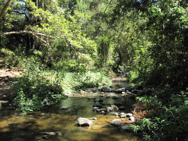
- Santa margarita river june 2011
- HistoryEdit
- Watershed and courseEdit
- Conservation and EcologyEdit
- References
Map of Santa Margarita River, California, USA
Santa margarita river june 2011
HistoryEdit
The Portolà expedition camped on the river on July 20, 1769 and named it for Saint Margaret of Antioch. A Santa Margarita rancheria is mentioned in 1795 and there is a February 23, 1836 land grant called Santa Margarita y San Onofre (later renamed Rancho Santa Margarita y Las Flores).
The river was the site of several attempts to build railroads in the 1880s. During much of the 20th century the river was the subject of a long-running water rights battle between the United States Navy and the Fallbrook Public Utility District. The conflict was resolved in 1967 and the following year both entities proposed to jointly construct dams on the river. The proposal was abandoned in 1984 due to environmentalist opposition.
Watershed and courseEdit
The mainstem of the Santa Margarita River begins at the confluence of Temecula Creek and Murrieta Creek, in southwestern Riverside County, east of Interstate 15, 0.5 miles (0.80 km) southeast of Temecula. It flows southwest through the 5 miles (8.0 km) Temecula Canyon at the south end of the Santa Ana Mountains. Along its lower 10 miles (16 km) the river forms a large floodplain as it crosses Camp Pendleton Marine Corps Base. It enters the Gulf of Santa Catalina on the Pacific approximately 3 miles (4.8 km) northwest of Oceanside.
Draining 1,922 square kilometres (742 sq mi), the Santa Margarita Watershed is the second largest river basin on the Southern California coastal plain. The upper watershed consists of the 575 square kilometres (222 sq mi) Murrieta Creek subwatershed and the 948 square kilometres (366 sq mi) Temecula Creek subwatershed. Although there are two dams in the upper watershed, both dams must release water that roughly corresponds to natural flows in the tributaries that they are on. As a result, the flow of water in the Santa Margarita River is very close to what it would be in the absence of those two dams.
Below the confluence of Murrieta and Temecula Creeks, the primary tributaries of the Santa Margarita River mainstem are Rainbow Creek on the left (headingdownstream) and Sandia Creek and De Luz Creeks on the right. The two latter creeks drain the Santa Rosa Plateau.
Conservation and EcologyEdit
Approximately 4,334 acres (1,754 ha) of the middle course of the Santa Margarita River in Temecula Canyon are managed by San Diego State University as the Santa Margarita Ecological Reserve, a collaboration of the Bureau of Land Management, California Department of Fish and Wildlife and The Nature Conservancy. The Nature Conservancy has identified and continues to acquire land along the river for conservation. Downstream from the Ecological Preserve the river flows through lands owned by the Fallbrook Public Utility District, and empties into the Ocean through the largely undisturbed lands of Camp Pendleton. Thus the mainstem flows through undeveloped, protected lands. The river has unusual habitats with the upper mainstem one of the few remaining natural gorge rivers in Southern California and the lower mainstem has expansive riparian strips, some up to 1.5 kilometres (0.93 mi) across.
Approximately 70 species of special concern (rare, threatened, or endangered) regularly inhabiting the watershed, including 30 that are currently protected under the Endangered Species Act. Two federally endangered riparian birds are the least Bell's vireo (Vireo bellii pusillus) and the southwestern willow flycatcher (Emmpidonax traillii extimus)), both of which require riparian habitat for breeding success.
Major fishes in the Santa Margarita River include the rainbow trout (Oncorhynchus mykiss), arroyo chub (Gila orcuttii), California killifish (Fundulus parvipinnis), striped mullet, longjaw mudsucker, staghorn sculpin. Aquatic and semi-aquatic mammals include California golden beaver (Castor canadensis subauratus), muskrat, raccoon and long-tailed weasel. Contemporary beaver populations survive at the headwaters of the Santa Margarita River at the confluence of Temecula Creek and Murrieta Creek.
Major riparian plants include arroyo, black, narrowleaf, Pacific, and red willow (Salix spp); California sycamore (Platanus racemosa), Fremont cottonwood (Populus fremontii), mulefat (Baccharis salicifolia) and White alder (Alnus rhombifolia).