Country United States of America Population 172,794 (2013) Unemployment rate 5.5% (Feb 2015) Area 42.174 sq mi | State | |
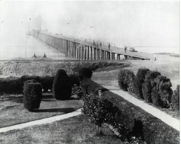
Colleges and Universities MiraCosta College Points of interest Oceanside Pier, Mission San Luis Rey de Francia, California Surf Museum, Heritage Park Village & Museum, Oceanside Museum of Art | ||
Oceanside is a coastal city located on Californias South Coast. It is the third-largest city in San Diego County, California. The city had a population of 167,086 at the 2010 census. Together with Carlsbad and Vista, it forms a tri-city area. Oceanside is located just south of Marine Corps Base Camp Pendleton.
Contents
- Map of Oceanside California
- Pacific place a merrill garden community assisted living oceanside ca california
- Visit wyndham oceanside pier resort for best family travel experience in california
- History
- Geography
- Economy
- Attractions
- Rubys diner oceanside california great food and sunset
- References
Map of Oceanside, California
Pacific place a merrill garden community assisted living oceanside ca california
Visit wyndham oceanside pier resort for best family travel experience in california
History

Originally inhabited by Native Americans, the first European explorers arrived in 1769. Spanish missionaries under Father Junipero Serra founded Mission San Luis Rey de Francia on a former site of a Luiseno Indian village on the banks of the San Luis Rey River. In the early 19th century, the introduction of farming and grazing changed the landscape of what would become Oceanside. The area—like all of California—was under Spanish, then in 1821 under Mexican rule, and conquered by the U.S. in 1848.

In the late 1850s, Andrew Jackson Myers lived in San Joaquin County. A native of LaSalle County, Illinois, he returned in the late 1880s and lived in San Luis Rey. In 1882 Myers moved on the land that was the original town site for Oceanside. A patent for the land was issued in 1883 by the federal government. It was incorporated on July 3, 1888. The city hall as of the early 21st century stands on the former Myers homestead.
In the 20th century, Oceanside was a beach town devoted to activities on a 6-mile (9.7 km) stretch of beaches. Residential areas like downtown (built in the 1890s), South Oceanside (built in the 1920s and 1930s), and developments east of Interstate 5 (built after World War II) are preserved and remodeled when these houses are considered to have historical value. Since the establishment of Marine Corps Base Camp Pendleton in 1942, Oceanside has been home to U.S. armed forces personnel, and the wartime industry of WWII and the 1950s had an ammunition manufacturing facility in the city.
In 1970, the Census Bureau reported citys population as 91.0% white, 5.1% black and 1.7% Asian. After 1970, the main focus of Oceanside was suburban development and a choice for newcomers to move into then relatively affordable housing. Oceanside continues to be known for the value and appreciation as a vacation home market.
Geography

Oceanside is at 33°12?42?N 117°19?33?W (33.211566, -117.325701).

According to the United States Census Bureau, the city has a total area of 42.2 square miles (109 km2). 41.2 square miles (107 km2) of it is land and 0.9 square miles (2.3 km2) of it (2.23%) is water.
Traveling north on Interstate 5, Oceanside is the last city before Orange County. As the crow flies, it is roughly the same distance from Aliso Viejo as it is to downtown San Diego.
Economy
According to the Citys 2009 Comprehensive Annual Financial Report, the top employers in the city are:
